Structures in Quebec
A B C D E F G H I J K L M N O P Q R S T U V W X Y Z| Location | Details | Notes |
| Aylmer, QC Near Rivermead GPS 45.39375, -75.79106 Near Foley and Dickens GPS 45.384331, -75.820601 | 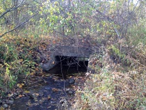 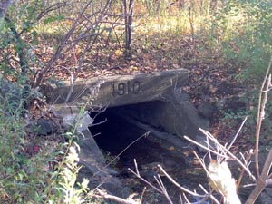 Two concrete culverts under the former CPR Waltham sub
and probably HER tracks. The spacing between sides of the culverts
looked like it could support 3 tracks. I think in these places the two
HER tracks ran right beside the CPR ones. Both culverts are of the same
style and both are labelled 1910 on the north side. The south side is
blank. I just took photos of
the Rivermead one. Malcolm Vant October 2015 | |
| Aylmer, QC GPS 45.386321 -75.803226 | 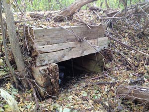 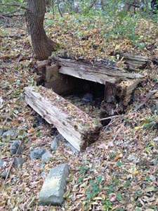 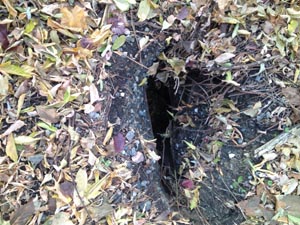 Wooden culvert under the former Waltham sub just south of the
HER Car Barn. The CPR went south of the barn and the HER tracks north
of it. There is a hole in the culvert from the top - good
place to get a bike wheel stuck, but luckily I didn't! This culvert is
only about one track wide. Malcolm Vant October 2015 | |
| Between Bristol, QC and Fitzroy, ON GPS 45.466511, -76.286432 | CN (CNoR) bridge over the Ottawa River, abandoned line between Pembroke and Ottawa, Nepean Junction. | 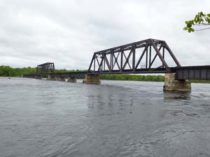 Colin Churcher 2013 |
| Campbells Bay, QC Just east ot town centre GPS 45.729694, -76.599639 | Small one piece I-beam steel bridge (CP (PPJ), replaced in the 1960s. The Cyclopark PPJ: a Pontiac Train Story | 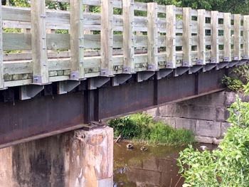 Photo by Malcolm Vant August 2016 |
| Dalhousie Mills, QC GPS 45.298152, -74.453694 | Circular stone base and tank (CP) | 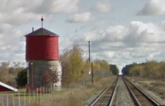 Street View October 2012 |
| Davidson, QC on the eastern approach to Davidson, just before the Davidson sawmill. GPS 45.867758, -76.757417 | 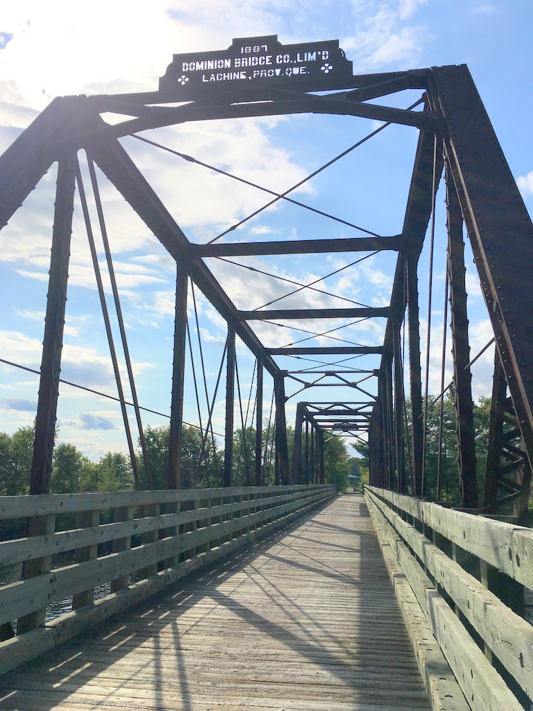 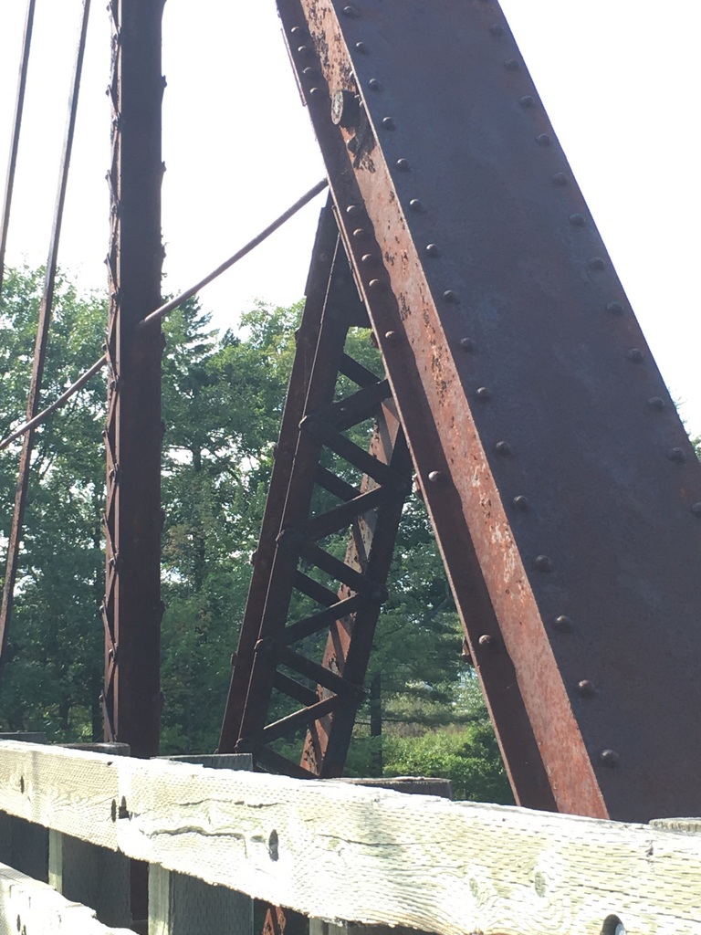 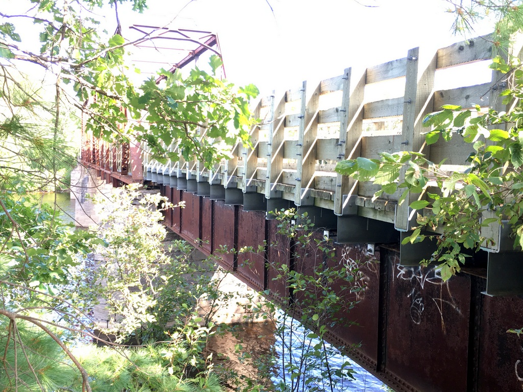 The west
end of the bridge is riveted plate DPG construction and then the rest is
a truss bridge. The two types of bridging are shown in the right photo. All photos by Malcolm Vant August 2016. The Cyclopark PPJ: a Pontiac Train Story | |
| Duhamel, QC Iroquois, 4.8 km south | Bridge over Iroquois Creek, TNVR rails removed 1986 | In 1987 Guide. Need to verify. |
| Gatineau, QC GPS 45.463229, -75.725023 | Former CPR Lachute sub bridge over the Gatineau River showing the
adaptation for Rapibus use and the addition of a cycling lane on the
outside of the original bridge. Photo taken by Malcolm Vant in Oct 2013 | 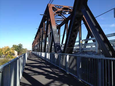 |
| Gatineau (Hull), QC Brewery Creek near the site of former Hull Beemer station. GPS 45.435506, -75.726 | 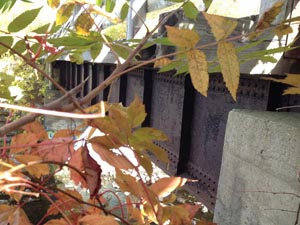 | 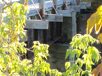 Photos by Malcolm Vant 2015 |
| Gatineau (Hull), QC GPS 45.424152, -75.724214 | 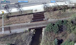 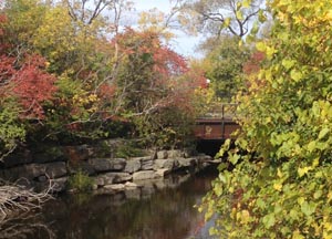 | E.B. Eddy bridge over Brewery Creek on the siding into Eddy's, section that runs parallel to Boulevard Alexandre Tachḗ. Malcolm Vant photos |
| Gatineau (Hull), QC GPS 45.430132, -75.704245 | Alexandra
or Interprovincial Bridge over Ottawa River. Southbound lane,
railway 1900-1960, northbound lane and walkway carried HER streetcars
1900-1947. Findings on the Interprovincial Bridge Centenary of the Interprovincial Bridge | 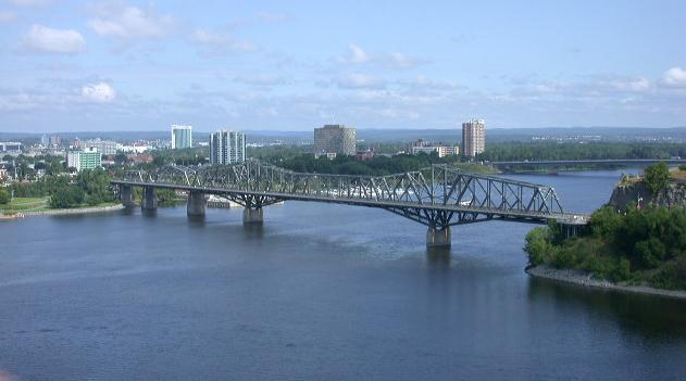 Colin Churcher photo 2002 |
| Gatineau (Hull), QC GPS 45.418539, -75.729655 | Prince of Wales Bridge (CP) | 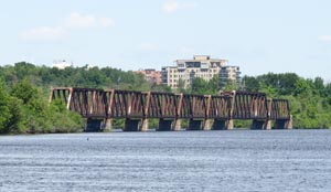 North part, Colin Churcher 2015 |
| Gatineau (Hull), QC North of Prince of Wales Bridge GPS 45.421589, -75.731597 |   Malcolm Vant photo October 2013 | HER streetcar bridge over CP formerly used by CP to gain access to E.B. Eddy. |
| Hull, QC | see Gatineau | |
| Kazabazua, QC Veloroute/Cyclepath des Draveurs GPS 45.945052, -76.054182 | CP bridge over Kazabazua river, rails removed 1986. It is believed that this is a "trail bridge" to replace the original railway bridge. Confirmation and picture required. | 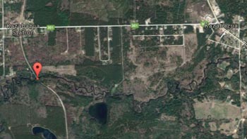 Google Earth 2017 |
| Lachute, QC Abutments from GN bridges over Riviere du Nord. Two locations GPS 45.657541, -74.342783 GPS 45.656104, -74.350308 | 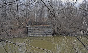 East abutment on the West River, taken from the west abutment Photo by Gerry Gaugl April 18 2015 GPS 45.655917, -74.351333 | 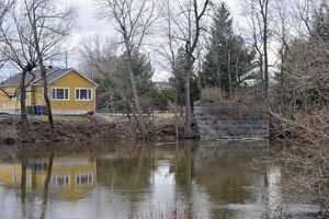 West abutment on main branch Photo by Gerry Gaugl April 18 2015 GPS 45.657500, -74.343556 |
| Low, QC Just south of the village | Abutments from CP bridge over Stagg Creek, rails removed 1986, bridge removed 1987 and a "Trail Bridge" installed. | Need picture |
| Between Portage du Fort, QC and Ontario, ON GPS 45.613624, -76.671870 | CN (CNoR) bridge across the Ottawa River, abandoned line between Pembroke and Ottawa, Nepean Junction. | 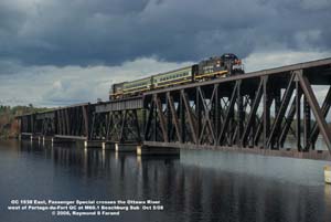 Photo by Raymond Farand October 2008 |
| Singer, QC 1.6 km north | Two TNVR steel bridges, rails removed 1987. | In 1987 Guide. Need to verify. |
| Singer, QC 1.6 km south GPS 45.889911, -75.131585 | One TNVR steel bridge, formerly CP turntable, rails removed 1987 | From Google earth 2017 would appear to be still in place. |
| Vinton, QC 4 km west of village, just west of Callaghan Rd. GPS 45.809472, -76.662639 | 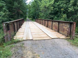 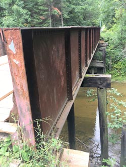 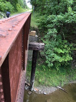 Photos by Malcolm Vant August 2016. Ray Farand writes:(7/2019) "Seems to me that I remember the current plate girder bridge being changed out in the late 50s early 60s. may be that the piles supported the previous structure and were never removed when the replacement bridge was installed. The Cyclopark PPJ: a Pontiac Train Story | |
| Wakefield, QC GPS 45.640885, -75.927578 | Turntable installed in 1974 for the steam train, now disused. | 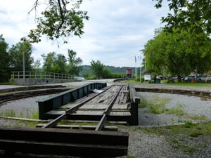 Photo Stu Moxley August 2015 |
| Wakefield, QC GPS 45.640098, -75.927732 | Water tank installed in 1992 for the steam train, now disused | 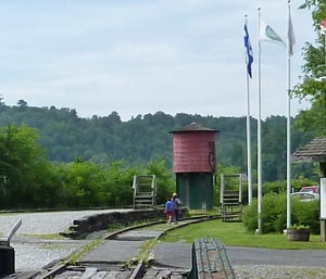 Photo Stu Moxley August 2015 |
Updated 7 July 2019
