Structures in Ontario, includes Water Tanks
A B C D E F G H I J K L M N O P Q R S T U V W X Y Z| Location | Details | Notes |
| Almonte, ON Little Bridge Street CP steel overbridge GPS 45.225921,-76.194497 | 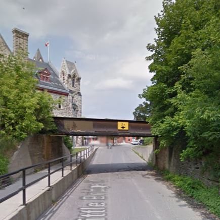 Street View June 2012 | |
| Almonte, ON GPS 45.226828, -76.195733 CPR Chalk River subdivision, bridge over the Mississippi River. Note it is blocked off for pedestrians, although the rest of the line is now multi-use pathway. | 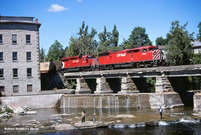 Robert Heathorn picture - date unknown | 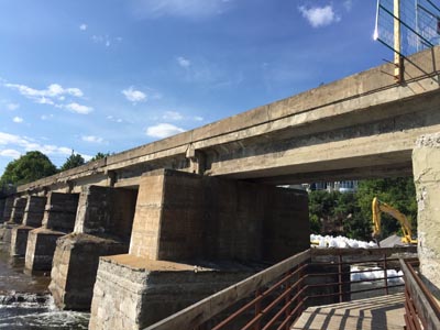 Photo by Bernie Geiger August 2016 |
| Arnprior, ON | Narrow gauge clay unloading shed, Dochart brick and Tile. | In 1987 Guide. Need to verify. |
| Arnprior, ON GPS 45.429627, -76.351125 | CN (GT, OAPS) steel trestle over Madawaska River, now disused | 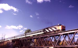 |
| Arden, ON Just west of village | Small steel bridge, CP Glen Tay to Tweed Line | In 1987 Guide. Need to verify. |
| Arden, ON 1.6 km west of village | 80 meter long trestle over swamp. CP Glen Tay to Tweed line | In 1987 Guide. Need to verify. |
| Ardendale, ON 1.6 km west | 25 meter long steel bridge near Lake Buck. CP Glen Tay to Tweed line | In 1987 Guide. Need to verify. |
| Ashton, ON Concrete culverts from former CPR Carleton Place subdivision Now Carleton Place Trailway. GPS 45.146771, -76.111092 (left) | 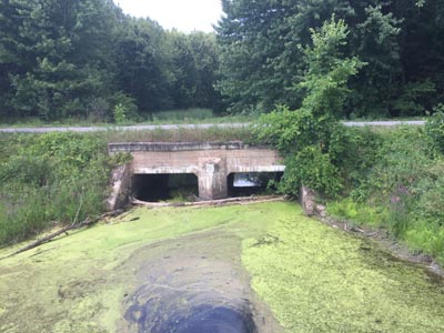 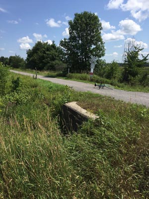 Photos by Eugene Kirkham July 2018 | |
| Aultsville, ON GPS 44.966681, -75.031475 | Concrete culvert from the original GT/CN main line (dated 1916), this part of the former line is used as Morrisons Road to access the Bird Sanctuary | Need picture |
| Near Barryvale CP (K&P) causeway GPS 45.284167, -76.726667 | 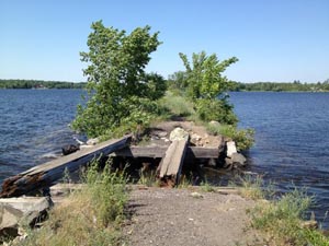 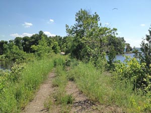 Photos by Malcolm Vant 21 June 2012 | |
| Barrys Bay, ON GPS 45.486714, -77.675806 | Complete CN water tank preserved by community | 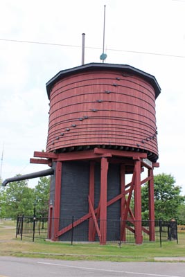 Photo by Jeff Hill July 2015 |
| Berwick, ON South side of Finch Concession 4-5 Road GPS 45.16395, -75.103533 | Culvert for NYC over the J.D. Forsyth Drain | Need picture |
| Berwick, ON North of Berwick Road GPS 45.1785, -75.114281 | Remains of abutments, unsure if original bridge of NYC, over Payne River Branch | Need picture |
| Black River, ON North of settlement GPS 45.082325, -74.879492 | Remnants of abutments of former bridge crossing of NYC over the Raisin River | Need picture |
| near Bourget, ON 16 km east CP (M&O) Bridge over Cobbs lake Creek on Prescott - Russell Recreational Trail GPS 45.450850, -75.106737 | 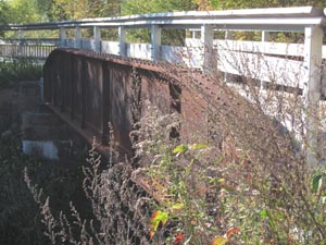 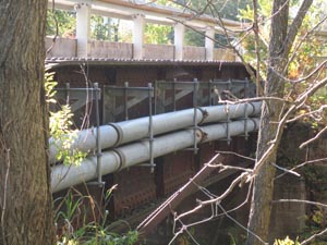 Photos by Malcolm Vant 26 September 2011 The original bridge has been re-decked and has new railings added for the rail trail. | |
| Bridge End, ON East of former grade crossing of Curry Hill Road GPS 45.2668, -74.431908 | Deck bridge crossing of Beaudette river for CP (former Cornwall sub), now part of "the Peanut Line Trail" | Need picture |
| Bridge End, ON East of former grade crossing of 3rd Line Road GPS 45.2668, -74.450378 | Concrete culvert crossing for CP (former Cornwall sub) over Wood Creek, now part of "The Peanut Line Trail" | Need picture |
| Bridge End, ON East of former grade crossing of 3rd Line Road GPS 45.249514, -74.450378 | Concrete culvert crossing for CP (former Cornwall sub) over Wood Creek, now part of "The Peanut Line Trail" | Need picture |
| Brockville, ON Waterfront Park South Portal GPS 44.589624, -75.681801 North Portal GPS 44.593258, -75.686313 | First railway tunnel in Canada, historic monument (CP (CCR) | 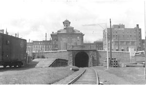 CSTM Mattingly Collection Matt-0175 |
| Brockville, ON McNair Island GPS 44.594721, -75.663768 Murray Island GPS 44.593593, -75.662471 | Two bridge piers from proposed bridge to connect Brockville, ON with Morristown, NY. Only these two structures were completed before the B&NYB project was abandoned. There is a lighthouse on one pier. | 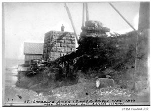 CSTM Howland -012 |
| Brooke, ON Near junction with road to Christie Lake | Concrete bridge. CP Glen Tay to Tweed line | In 1987 Guide. Need to verify. |
| Calabogie, ON North bridge over Madawaska River. CP (K&P) Part of the K&P Rail Trail. 45.301408, -76.719939 | 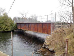 Photo by Malcolm Vant 2015 | |
| Calabogie, ON South bridge over Madawaska River. CP (K&P) Part of the K&P Rail Trail. 45.299436, -76.717850 | 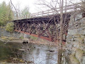 Photo by Malcolm Vant 2015 | |
| Chesterville, ON At the end of McMillan and King Streets. GPS 45.106226, -75.230156 | Circular concrete and stone base for CP water tank. | 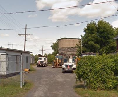 Street View July 2013 |
| Cornwall, ON North side of Second Street West GPS 45.015017, -74.750814 | Every concrete foundation posts for the NYC water tower and sewer/manhole access | Need picture |
| Cornwall, ON North side of Marleau Avenue and Glenview Boulevard GPS 45.042519, -74.697461 | Marleau Avenue Yard with loading ramp (has been unused since Roadrailer was cancelled) | Need picture |
| Cornwall, ON East of corner of 10th Street East and Virginia Drive GPS 45.039256, -74.710081 | Concrete culvert for a branch of Fly Creek on old CN main line, now the Cornwall Spur | Need picture |
| Cornwall, ON South side of 10th Street East GPS 45.035956, -74.718319 | Concrete culvert for a branch of Fly Creek on old CN main line, now the Cornwall Spur | Need picture |
| Cornwall, ON North of Toll Gate Road grade crossing GPS 45.0371, -74.771389 | NYC stone or concrete whistle post, repurposed by CN for Wesco Spur as a marker. | Need picture |
| Cornwall, ON West of Laflin Street GPS 45.034242, -74.768433 | Culvert over a drain for the South Raisin River from NYC, reused by CN for Wesco Spur | Need picture |
| Cornwall, ON West of Three Nations Bridge in St. Lawrence River GPS 45.009794, -74.748672 | Roosevelt
International Bridge. Piers 5 through 8 remain on the shores and
in the St. Lawrence River; piers 9 and 10 with concrete footings of
viaduct in and on the sides of the Cornwall Canal. Bridge was for
the NYC line orginally. There is also a swing gear left over from
the 1908 canal/bridge accident just to the west of the bridge location. See ../circle/Findings_ONY.htm | 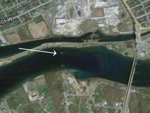 Need picture |
| Cornwall, ON North of Toll Gate Road grade crossing GPS 45.038672, -74.772933 | Culvert over a drain for the South Raisin River from NYC, reused by CN for Wesco Spur | Need picture |
| Cornwall, ON South of Cornwall Centre Road GPS 45.049556, -74.787772 | NYC abutments and possible original bridge (unsafe to use) dislodged from abutments (farmer built a new bridge just on the east side of this one), crossing the South Raisin River | Need picture |
| Cornwall, ON GPS 45.050975, -74.711683 | Small concrete bridge for CP (Cornwall sub) over a swamp | Need picture |
| Cornwall, ON West of Virginia Drive GPS 45.040211, -74.718131 | Deep fill and culvert for CP over Fly Creek | Need picture |
| Cornwall, ON NE corner fo Adolphus St and 6th St East GPS 45.026475, -74.726606 | Turntable pit for CP | 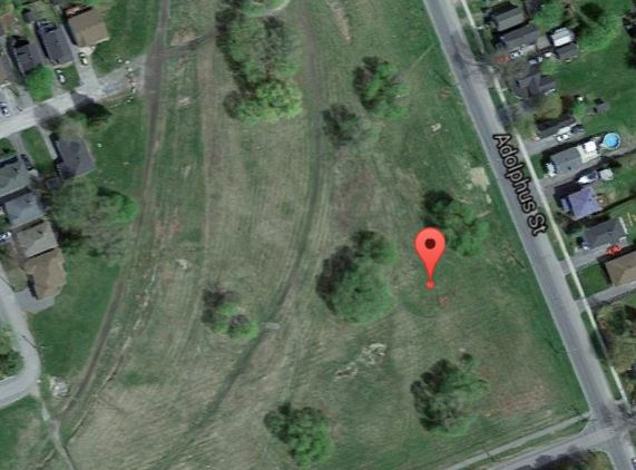 Need picture |
| Cornwall Centre, ON Near the Trout Quarry GPS 45.056072, -74.818778 | NYC culvert over a drain to the Trout Quarry | Need picture |
| Cornwall Centre, ON Between Post Road and Atchison Road GPS 45.057936, -74.834489 | NYC concrete bridge over a creek. | Need picture |
| Crysler, ON Charles Street, County Road 13, south side. GPS 45.213186, -75.158536 | Abutments for NYC bridge over South Nation River | 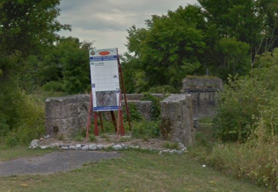 From Street View. Need picture. |
| Delta, ON Near Phillipsville | Two bent trestle CN (BWSSM) | In 1987 Guide. Need to verify. |
| Douglas, ON West of town GPS 45.499961, -76.949175 | Two span girder bridge over Bonnechere River (CP), bridge removed, concrete abutments and centre pier remain. Access to north (east) end of bridge about 1km walk along Jaime Kilby Nature Trail (trail is quite rough especially close to bridge site). Can see bridge site in distance from Hyndford Road on south side but cannot get close (private land). | 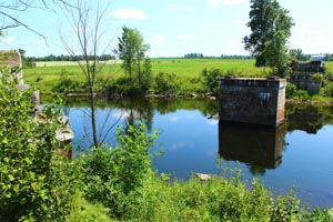 Jeff Hill photo 26 July 2015 |
| Embrun, ON St. Joseph Street | NYC bridge abutments | Need to verify. |
| Finch, ON South of Finch Concession 1-2 Road GPS 45.136292, -75.0564 | Culvert for NYC to cross a drain | Need picture |
| Finch, ON North side of Finch Concession 1-2 Road GPS 45.137594, -75.061911 | Culvert for NYC to cross a drain | Need picture |
| Finch, ON North side of County Road 43 GPS 45.145069, -75.081403 | NYC bridge over Casselman Drain | Need picture |
| Finch, ON West side of Crysler Road GPS 45.150381, -75.09285 | NYC culvert over a creek | Need picture |
| Between Fitzroy, ON and Bristol, QC GPS 45.466511, -76.286432 | CN (CNoR) bridge over the Ottawa River, abandoned line between Pembroke and Ottawa, Nepean Junction. | 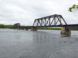 Colin Churcher 2013 |
| Gananoque, ON Water front | Swing bridge, was road - rail, now road only CN (TIR) | In 1987 Guide. Need to verify. |
| Glen Donald, ON (Cornwall) east of Boundary Road GPS 45.074506, -74.686197 | Culvert for CP (Cornwall sub) over Farlinger Branch | Need picture |
| Glen Gordon, ON South side of Bourdeau Road GPS 45.201008, -74.502197 | Culvert for CP (Cornwall sub) over Westleys Creek | Need picture |
| Glen Gordon, ON East side of 1st Line Road GPS 45.197497, -74.506147 | Culvert for CP (Cornwall sub) over a branch of Westleys Creek | Need picture |
| Glen Gordon, ON West side of where 1st Line Road bends. GPS 45.192711, -74.511517 | Culvert for CP (Cornwall sub) over Ferguson Drain | Need picture |
| Glen Gordon, ON North of Concession Road 3. GPS 45.182292, -74.523192 | Culvert for CP (Cornwall sub) over Pattingale Creek | Need picture |
| Glen Gordon, ON South of Cedar Grove Road GPS 45.175939, -74.530869 | Concrete bridge for CP (Cornwall sub) over Finney Creek | Need picture |
| Glen Gordon, ON South of Cedar Grove Road GPS 45.172144, -74.537775 | Culvert for CP (Cornwall sub) over a branch of Finney Creek | Need picture |
| Glen Tay, ON 1.6 km west of village | Double concrete culvert, CP Glen Tay to Tweed line. | In 1987 Guide. Need to verify. |
| Glenbrook, ON West of County Road 27 GPS 45.121147, -74.623636 | Culvert for CP (Cornwall sub) over a branch of Spring Creek Drain | Need picture |
| Glenbrook, ON West of Glenbrook Road GPS 45.099428, -74.651106 | Culvert for CP (Cornwall sub) over the Spring Creek Drain | Need Picture |
| Glenbrook, ON East of Cashion Road GPS 45.091597, -74.659017 | Culvert for CP over Cooper Drain | Need picture |
| Harrisons Corners, ON northwest of village between county road 18 and Eamer Road GPS 45.0912, -74.916339 | NYC culvert/bridge over Wereley Creek | Need picture |
| Hungerford, ON 4.8 km west of village | Small steel bridge (CP) | In 1987 Guide. Need to verify. |
| Iroquois, ON East of town on County Road 2 GPS 44.856414, -75.289069 | Concrete abutments for bridge over Doran Creek on original CN/GT pre-Seaway alignment | Need picture |
| Kaladar, ON West of village | Ruins of CP concrete loading structure | In 1987 Guide. Need to verify. |
| Kaladar, ON 4.8 km west of village | Two small steel bridges from CP Glen Tay to Tweed line. | In 1987 Guide. Need to verify. |
| Killaloe, ON GPS 45.197456, -74.875547 | Former through CN girder bridge being used as part of a walking trail over a small creek that runs through the village. A wooden roof and deck has been added, but otherwise the bridge looks original, including a mileage board on the north side | 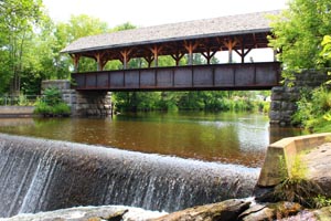 North side, Jeff Hill 25 July 2015 |
| Maberly, ON South of village, mile 13.5 Havelock sub. GPS 44.822362, -76.556272 | CP steel girder bridge, 84'8" over Fall River, Glen Tay to Tweed line. | 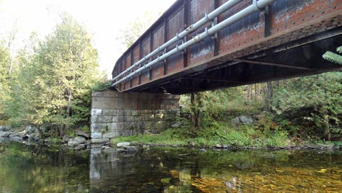 Picture by Gene Kirkham September 2020 |
| Maberly, ON Concrete culvert at Bolingbroke road crossing, mile 13.2 Havelock sub. Likely 1907 GPS 44.821654,-76.530518 | 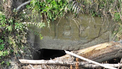 | |
| Monkland, ON At end of station street GPS 45.197508, -74.875322 | 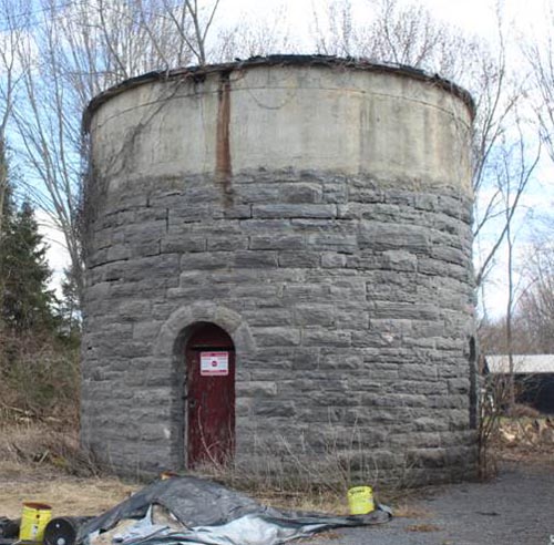 Circular concrete and stone base for CP water tank | 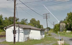 Street View July 2013 |
| Morrisburg, ON At the end of Village Road GPS 44.914639, -75.191711 | CN loading ramp, east of the station building | Need picture |
| Newboro, ON | CN (BWSSM) piers for bridge over the Rideau Canal | In 1987 Guide. Need to verify. |
| Newington, ON Southeast of Main Street and Helmer Road intersection GPS 45.118181, -75.003947 | Concrete bridge for NYC over a branch of the Newington Drain | Need picture |
| Newington, ON North of Fair Grounds GPS 45.124756, -75.019714 | Concrete bridge for NYC over the Newington Drain | Need picture |
| Newington, ON South of Waldroff Road GPS 45.127139, -75.027233 | Culvert for NYC over a branch of the Newington Drain | Need picture |
| Newington, ON North side of Waldroff Road GPS 45.129397, -75.035186 | Culvert for NYC over a branch of the Newington Drain | Need picture |
| North Lancaster Station, ON NE of grade crossing of 2nd Line Road GPS 45.239494, -74.461069 | Culvert for CP over the Gunn Creek | Need picture |
| North Lancaster Station, ON NE of grade crossing of 2nd Line Road GPS 45.233119, -74.467875 | Culvert for CP over a branch of the Sutherland Creek | Need picture |
| North Lancaster Station, ON NE of grade crossing of 2nd Line Road GPS 45.228731, -74.472519 | Culvert for CP over a branch of the Sutherland Creek | Need picture |
| North Lancaster Station, ON NE of grade crossing of 2nd Line Road GPS 45.227378, -74.473989 | Culvert for CP over a branch of the Sutherland Creek | Need picture |
| North Lancaster Station, ON NE of grade crossing of 2nd Line Road GPS 45.219372, -74.482536 | Culvert for CP over a branch of the Sutherland Creek | Need picture |
| North Lancaster Station, ON SW of grade crossing of 2nd Line Road GPS 45.216056, -74.486056 | Culvert for CP over a branch of the Sutherland Creek | Need picture |
| North Lancaster Station, ON SW of grade crossing of 2nd Line Road GPS 45.210619, -74.491864 | Bridge for CP over the Sutherland Creek | Need picture |
| Northfield Station, ON Southwest on NYC right of way. GPS 45.100442, -74.935836 | Former NYC gravel pit (opened in 1916), filled in with water | Need picture |
| Northfield Station, ON West side of McRae Road GPS 45.108697, -74.966 | Abutments for former NYC bridge over Dixon Creek. | Need picture |
| Ottawa, Britannia, ON Trans-Canada Trail GPS 45.355288, -75.809124 | End of Birchdale Avenue. Concrete culvert (1911) from former Carleton Place subdivision | 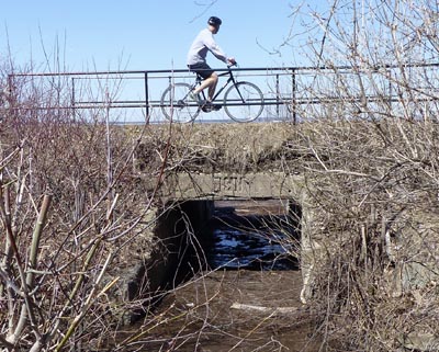 Photo by Deborah MosherS |
| Ottawa, Gloucester, ON Greens Creek, Montreal Road at Bearbrook | 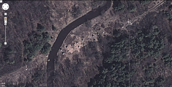 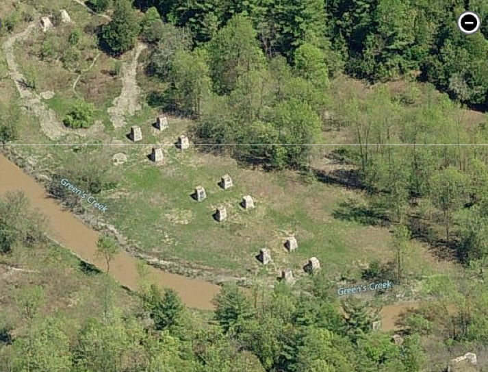 Concrete piers for trestle ../circle/Findings_Bridges.htm#CNORGreenscreekbridge | |
| Ottawa, Gloucester, Greens Creek What appears to have been an old railway bridge moved to a new off-railway location. GPS 45.417450, -75.594463 | 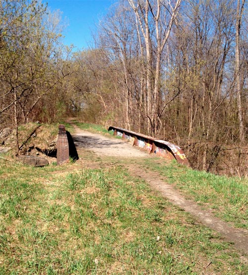 Photo by Royston Neale | |
| Ottawa, Hurdman, ON Pier foundations for Canadian Northern Railway bridge over the Rideau River can be seen at very low water. GPS 45.420145, -75.6645 Some broken remnants of the western abutment are hidden in a small copse at the edge of the present soccer field once occupied by the yards on CNR's Hurdman Line. It can be accessed from the bike path that joins the ex-CPR bridge with Strathcona Park in Sandy Hill.. GPS 45.419332, -75.665798 | 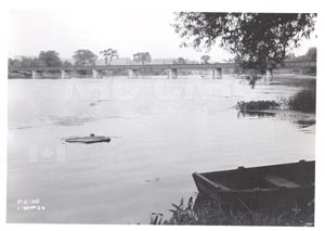 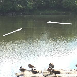 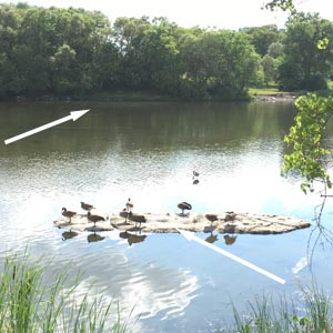 Color photos by Malcolm Vant July 2016. Arrows point to submerged piers. | |
| Ottawa, Kanata, Shetland Park Trans-Canada Trail GPS 45.297312 - 75.864953 | Concrete culvert (1911) where the west switch of Nepean Siding on the Carleton Place Sub was. | Need picture |
| Ottawa, Nepean, ON North of Queensway,north of Acres Road | Pilings for bridge over Stillwater Creek CN (OA&PS) | In 1987 Guide. Need to verify. |
| Ottawa, Nepean, ON In woods above Nepean Junction. GPS 45.338201, -75.869114 | Steel bridge beams (CN) The Nepean Junction Mystery For many years it was thought that this is a former railway bridge. Closer investigation suggests that this is more likely a single span old rural road bridge. - it is far too light. Railways did use beam bridges of similar depth/ length, but they would have multiple beams for adequate load carrying capacity. There is not even sufficient cross bracing to stiffen the span. - the "tie" is not a tie. Although of similar dimensions, it has never had rail spiked to it. - in all open deck railway bridges, even short ones, bridge ties are used. Regular track ties lack sufficient strength. - the rail has been drilled in multiple locations. No railway will/would do that to mount rail. It is likely the rail was used as a guardrail or for some other purpose. - it is a long way from a railway. There would be no reason for a railway to go to the trouble to place it here. | 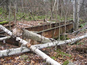 Photo by Colin Churcher Nov 2006 |
| Ottawa, Orleans, ON 6.4 km west on hwy 17 | Concrete block culvert over Leonard Creek CN (CNoR) | In 1987 Guide. Need to verify. |
| Ottawa, ON Carleton University between Parking Garage and Rideau River GPS 45.382819, -75.695521 The hnistory of this tramway can be found at https://churcher.crcml.org/circle/findings3.htm#CUtramway | Concrete ballast deck underpass, formerly passed a tramway under the railway. ../circle/findings3.htm#CUtramway The concrete slab with "1926" was replaced during the rebuilding of the line around 2013 | 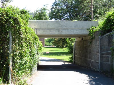 |
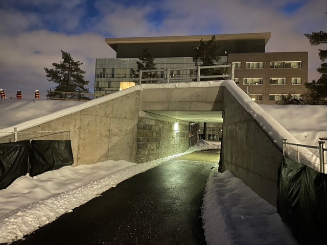 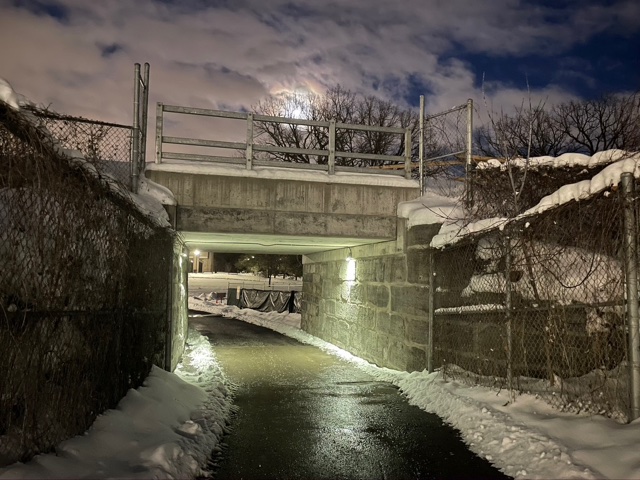 In 2020 the bridge was widened to accommodate double tracks while maintaining some of the historical features of the narrow gauge underpass, mostly on the west side (right hand photo. Both pictures by Bernie Geiger | ||
| Ottawa, ON South of Green Island GPS 45.437396, -75.690896 Piers for bridge over the Rideau River CP (B&P). | 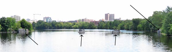 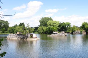  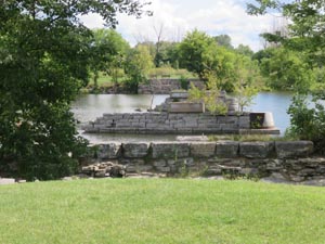 Colin Churcher photos July-August 2015 For more information, history etc, see https://churcher.crcml.org/circle/Findings_Bridges.htm#BPRideauRiverBridge | |
| Ottawa, ON Gatineau, QC GPS 45.429815, -75.703966 | Alexandra or Interprovincial Bridge over Ottawa River. Southbound lane, railway 1900-1960, northbound lane and walkway carried HER streetcars 1900-1947. Circle findings in the Interprovincial Bridge Centenary of the Interprovincial Bridge | 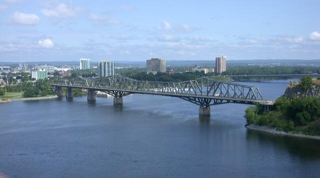 Colin Churcher photo 2002 |
| Ottawa, ON GPS between 45.428680, -75.699611 and 45.425736, -75.696494 | 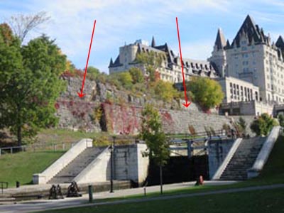 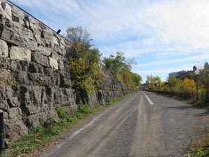 Three track railway formation built by Ottawa, Northern and Western Railway (later CP) to give access between the Interprovincial Bridge and Central Depot (later Union Station). the two outer tracks were used by the Hull Electric Railway and the centre track by CP (ONW). Now used as a parking lot | |
| Ottawa, ON Between Chateau Laurier and Union Station GPS 45.424669, -75.694409 | Hull Electric Railway turning circle in a tunnel under Rideau Street. Used by a bicycle rental company. (Rentabike Ottawa) This video shows the Hull Electric streetcar tunnel https://www.youtube.com/watch?v=UfPpXXK54A8 | 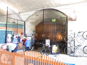 Colin Churcher Photo 2015 |
| Ottawa, ON Between Chateau Laurier and old Union Station. GPS 45.425002, -75.694412 | CN (GT) tunnel under Rideau Street for passengers to get to and from Union station from the Chateua Laurier. Tunnel intact but not in use. | 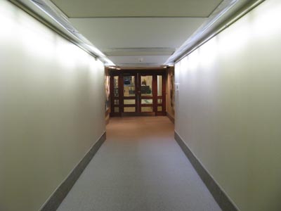 Photo by David Jeanes 2012 |
| Ottawa, ON Gatineau, QC GPS 45.415798, -75.727845 | Prince of Wales Bridge over Ottawa River CP (QMO.) Circle findings on the Prince of Wales Bridge | 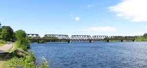 South side,Colin Churcher 2015 |
| Ottawa, ON Hurdman Bridge over Rideau River, south of Queensway. GPS 45.416366, -75.662841 | Steel bridge, originally CP M&O access to Union Station, now a footpath/bikeway ../circle/Findings_Bridges.htm#MORideauRiverBridge |  |
| Ottawa, ON Hurdman Bridge, south of former CP bridge over Rideau River (see above) GPS 45.415804, -75.663326 | Foundations of CN (GT, CAR) bridge over Rideau River, can be seen at low water. This was the CN access to Union Station. | 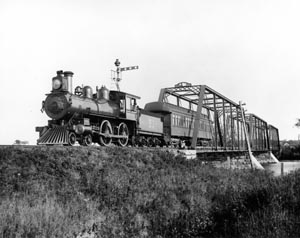 |
| Ottawa, ON Hurdman Bridge, north of the Queensway GPS 45.419446, -75.664546 | Foundations for bridge piers from CN (CNoR) bridge over Rideau River can be seen in the river bed at low water. Some cut stones can be found in the bush to the west. | |
| Ottawa, Dows Lake, ON When the Rideau Canal is being lowered the location of and parts of the CP Swing Bridge can be seen GPS 45.391461, -75.700897 | 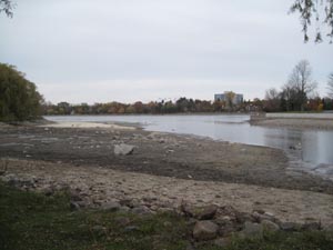 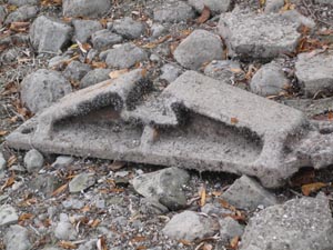 Photos by Malcolm Vant October 2011 | |
| Ottawa, ON McKeller at Ottawa River Parkway, foot of Wavell Ave., beside bike path. GPS 45.384729, -75.767702 Cement culvert from former CP Carleton Place subdivision. | 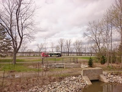 Photo by David James | 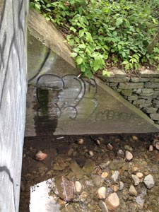 Photo Malcolm Vant 2015 |
| Pembroke, ON | Steel tank (CP) | In 1987 Guide. Need to verify. |
| Pembroke, ON Steel bridge GPS 45.824930, -77.124207 | 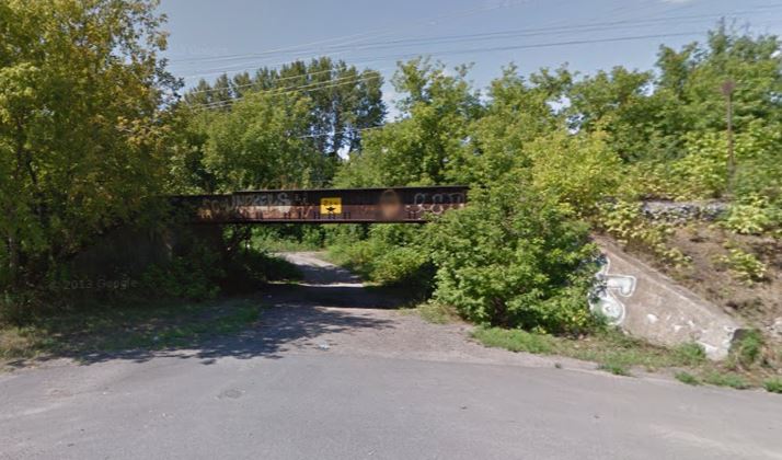 Street View August 2012 | |
| Pembroke, ON Alexander Street Concrete girder bridge GPS 45.826648, -77.118030 | 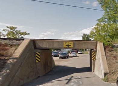 Street View August 2012 | |
| Pembroke, ON Steel bridge over Muskrat river GPS 45.828228, -77.112982 | 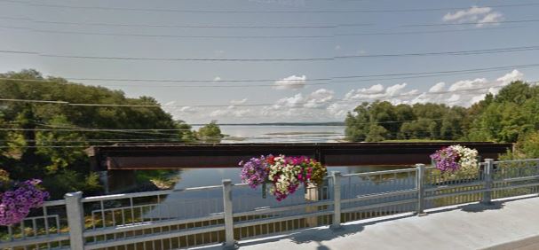 | |
| Pembroke, ON GPS 45.810281,-77.114868 | CN steel trestle | 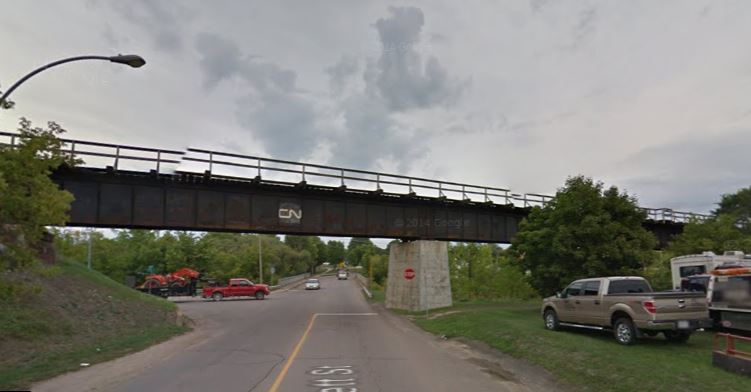 |
| Piperville, ON 4.8 km south of Ramsayville, south side of highway GPS 45.376392,-75.56702 | NYC 1927 concrete culvert | 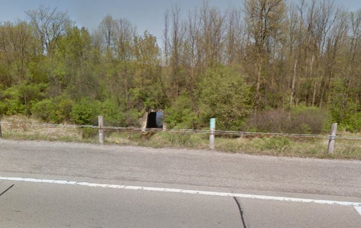 Paul Anderson from Google Streetview 2015 |
| Between Ontario, and Portage du Fort, QC GPS 45.613624, -76.671870 | CN (CNoR) bridge across the Ottawa River, abandoned line between Pembroke and Ottawa, Nepean Junction. | 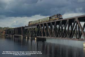 Photo by Raymond Farand October 2008 |
| Sharbot Lake, ON | CP (K&P) culvert and steel bridge | Need picture |
| Sharbot Lake, ON GPS 44.778458, -76.677560 | 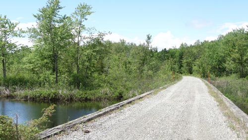 | Trans Canada Trail, Mile 20.7 Havelock sub A 399′, creosoted, ballasted deck, pile trestle known locally as the tar bridge. |
| Sharbot Lake, ON Just west of village Trestle and small steel bridges over arms of Sharbot Lake CP (K&P) GPS 44.766361, -76.689795 | 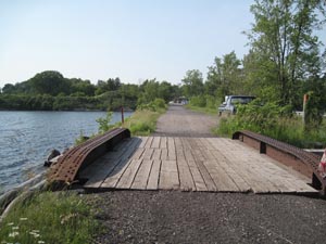 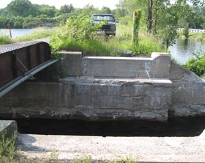 Malcolm Vant photos 2013 | 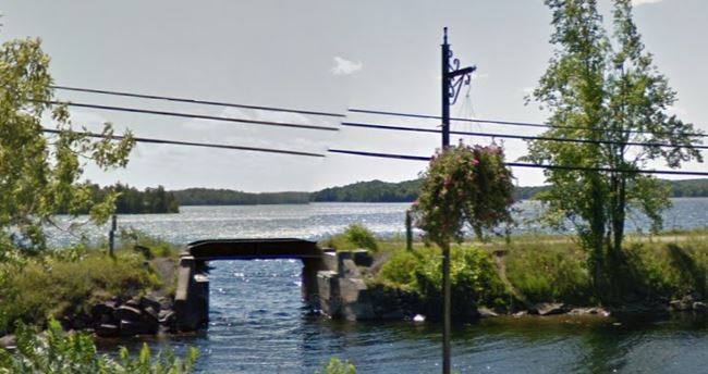 Street View June 2102 |
| Sharbot Lake, ON GPS 44.752185, -76.721125 | 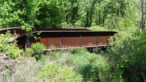 | HDPG 42′ 10″ according to the track plan. Trans Canada Trail, Mile 24 Havelock sub |
| Smiths Falls, ON | Lift bridge over Rideau River, historic monument | 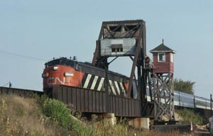 |
| Smiths Falls, ON GPS 44.906970, -76.015800 | CP turntable, disused and disconnected from railway yard. | 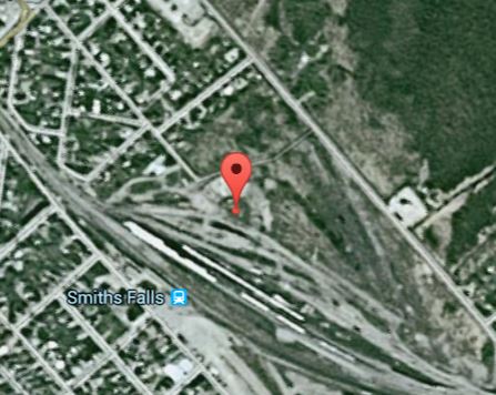 |
| St. Andrews West, ON North side of King's Road GPS 45.096694, -74.800019 | NYC Black River station signboard in collection of the Cornwall Township Historical Society at the Heritage Centre. | Need picture |
| Sulphide, ON West of village | Small steel bridges over Sulphide Creek, CP Glen Tay to Tweed line. | Need picture |
| Wales, ON (underwater) GPS 45.005156, -74.929094 | CN/GT stone arched bridge over Hooples Creek (now under water of Lake St. Lawrence) | Approximate GPS location |
| Wemyss, ON Just west of village Small steel bridge, CP Glen Tay to Tweed line. Mile 3.9 Havelock subdivision, location of original O&Q station GPS 44.868149,-76.389020 Photos by Eugene Kirkham | 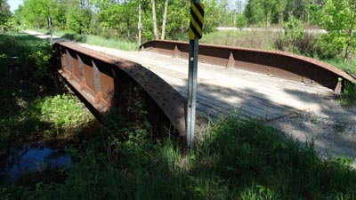 | 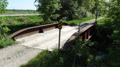 |
| Wemyss, ON Just west of village Small steel bridge, CP Glen Tay to Tweed line. Just west of Cameron Road, mile 4.2 Havelock subdivision, crossing of Rosedale Creek . GPS - 44.866994,-76.394609 Photos by Eugene Kirkham | 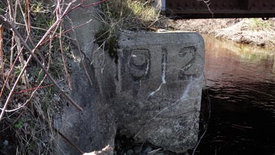 | 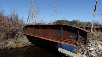 |
| Wemyss, ON Just east of village GPS: 44.870195, -76.379156 | Concrete
block culvert and small steel bridge, CP Glen Tay to Tweed line. mp.
3.41. The roadbed runs parallel to the Trans Canada Highway at this
point. Photo by Eugene Kirkham. | 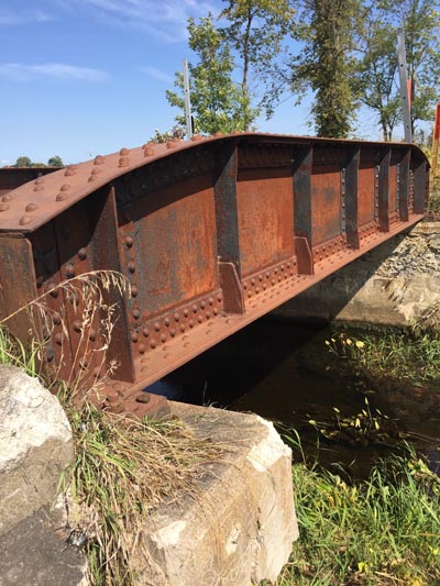 |
| Wendover, ON 6.4 km east of village near Jessups Falls GPS 45.565016, -75.069170 | Foundations of CN (CNoR) bridge over South Nation River | 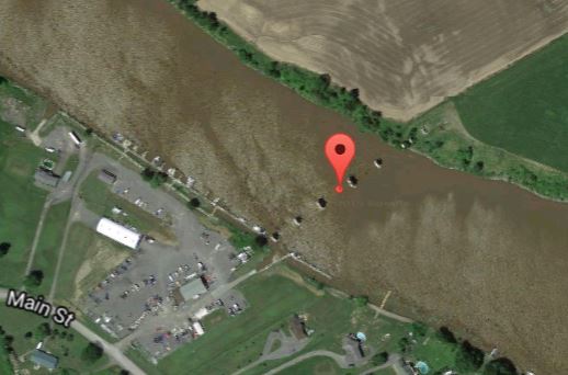 |
| Williamstown, ON East of County Road 19 GPS 45.158578, -74.575161 | Culvert for CP over a branch of the Raisin River | Need picture |
| Williamstown, ON Between Heron Road and John Street GPS 45.147614, -74.589144 | Steel deck bridge for CP over the Raisin River | Need picture |
| Williamstown, ON Between Heron Road and County Road 19 GPS 45.141761, -74.603458 | Culvert for CP over a branch of the South Raisin River | Need picture |
| Williamstown, ON south of County Road 19 GPS 45.136286, -74.603458 | Steel deck bridge for CP over the South Raisin River | Need picture |
Updated 24 January 2022
