Railway Maps of the Ottawa Area
(
Railway Association of Canada - Canadian Rail Atlas on Line
)
See Also
Links to Interesting Sites
Openrailwaymap.org is a detailed world wide railway map
https://www.openrailwaymap.org/
All time Railway Maps of Ottawa
Interactive Grand Trunk Railway Map of Ottawa
Railway Maps of the Ottawa Area 1935, 1991, 1999
Prepared by Chris Hall
Montreal and Ottawa Railway
Original Route Proposed through Pointe Fortune (provided by Chris Hall)
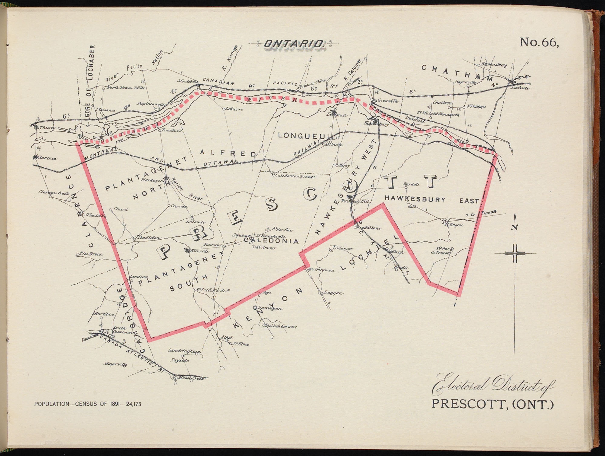
Prescott County
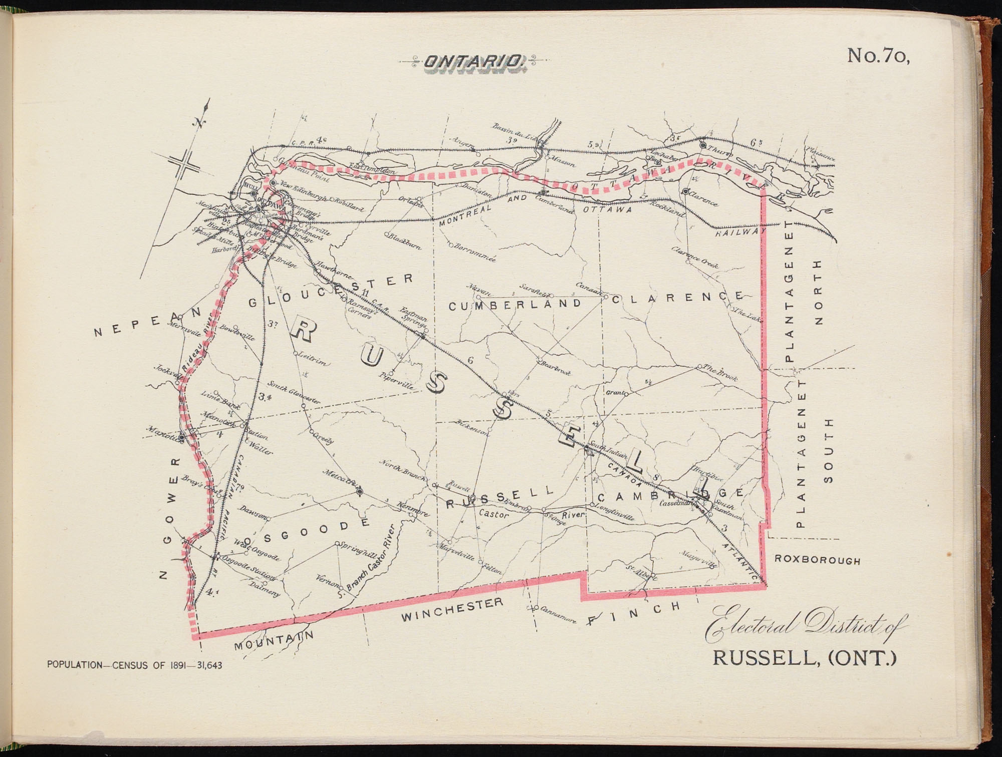
Russell County
Railway Development in Ottawa - From Colonel By to the OTrain
Powerpoint presentation given by Colin Churcher to the Bytown Railway Society
This shows the development of the railways in a series of maps. These are large files and the presentation is available either complete or broken into parts
Full Presentation (16 megs)
Part 1 1827 - 1894 (3megs)
Part 2 1895 - 1925 (7 megs)
Part 3 1925 - 1959 (4 megs)
Part 4 1960 - 1980 (6 megs)
Part 5 1980 - 2010 (6 megs)
Paul Delamere is preparing a series of detailed maps of the railways of Ontario and Quebec follow these links:
Ontario Railway Maps
Quebec Railway Map Project
Canadian Electric Railway Collection
Tracing the Lines : Eastern Ontario and West Quebec Railway History in Maps by Brian Gilhuly
https://search.adarchives.org/media/tracing-the-lines/tracing-the-lines.pdf
Ottawa's Railways Through the Years by K. Ballantyne
This map provides an interactive way to see how Ottawa's railway network has change since the first line was completed in 1855.
http://www.kballantyne.ca/geomatics/maps/ottawa-railways/
Ottawa Electric Railway, Ottawa Transportation Commission and OC Transpo route maps from 1929
MacOdrum Library, Carleton University
https://library.carleton.ca/find/gis/geospatial-data/oc-transpo-transit-routes
Stovels Railway, Commercial Routing and Shippers' Map of Ontario 1910
Stovel's railway, commercial routing and shippers' map of Ontario | digital.library.yorku.ca
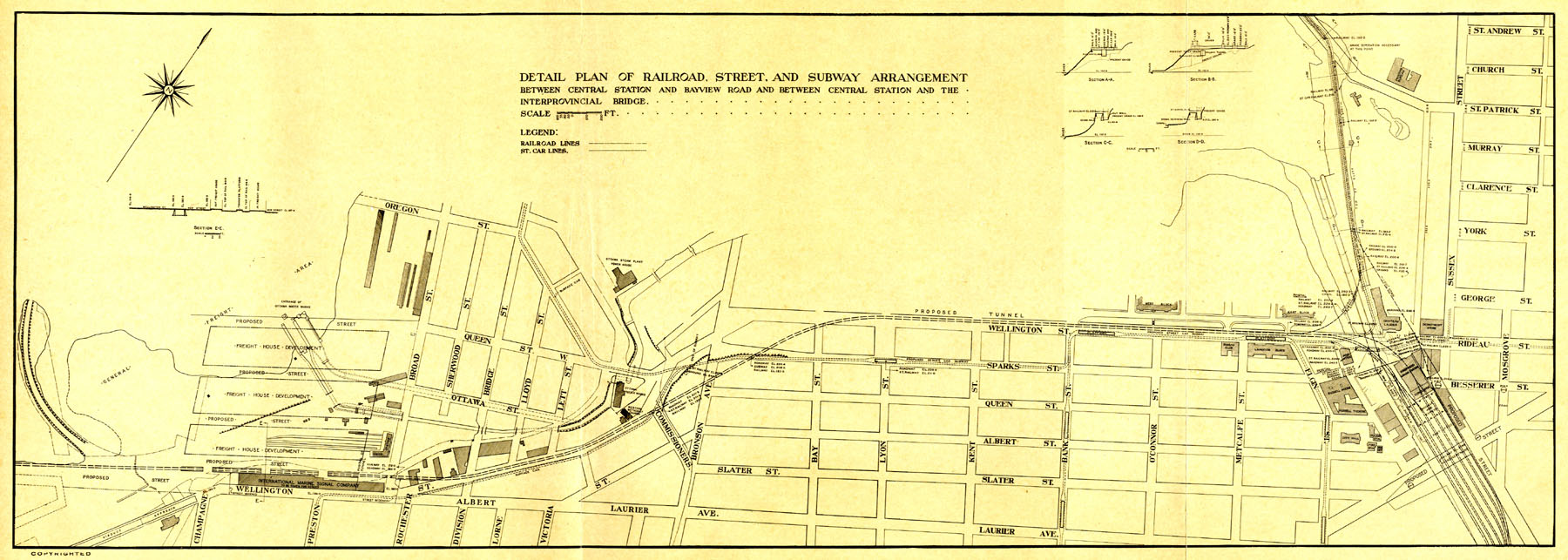
Report of the Federal Plan Commission: a General Plan for the Cities of Ottawa and the Hull (1915)
Statutory History of the Steam and Electric Railways of Canada 1836-1937
by Robert Dorman, Department of Transport 1939
Digitized by Google Books
https://1drv.ms/b/s!AtV76TBeh9q9gZl77j0WdTxC_fSXlA
The maps, dated 1941, which were published later can be found at
http://churcher.crcml.org/Map/Maps1941.html
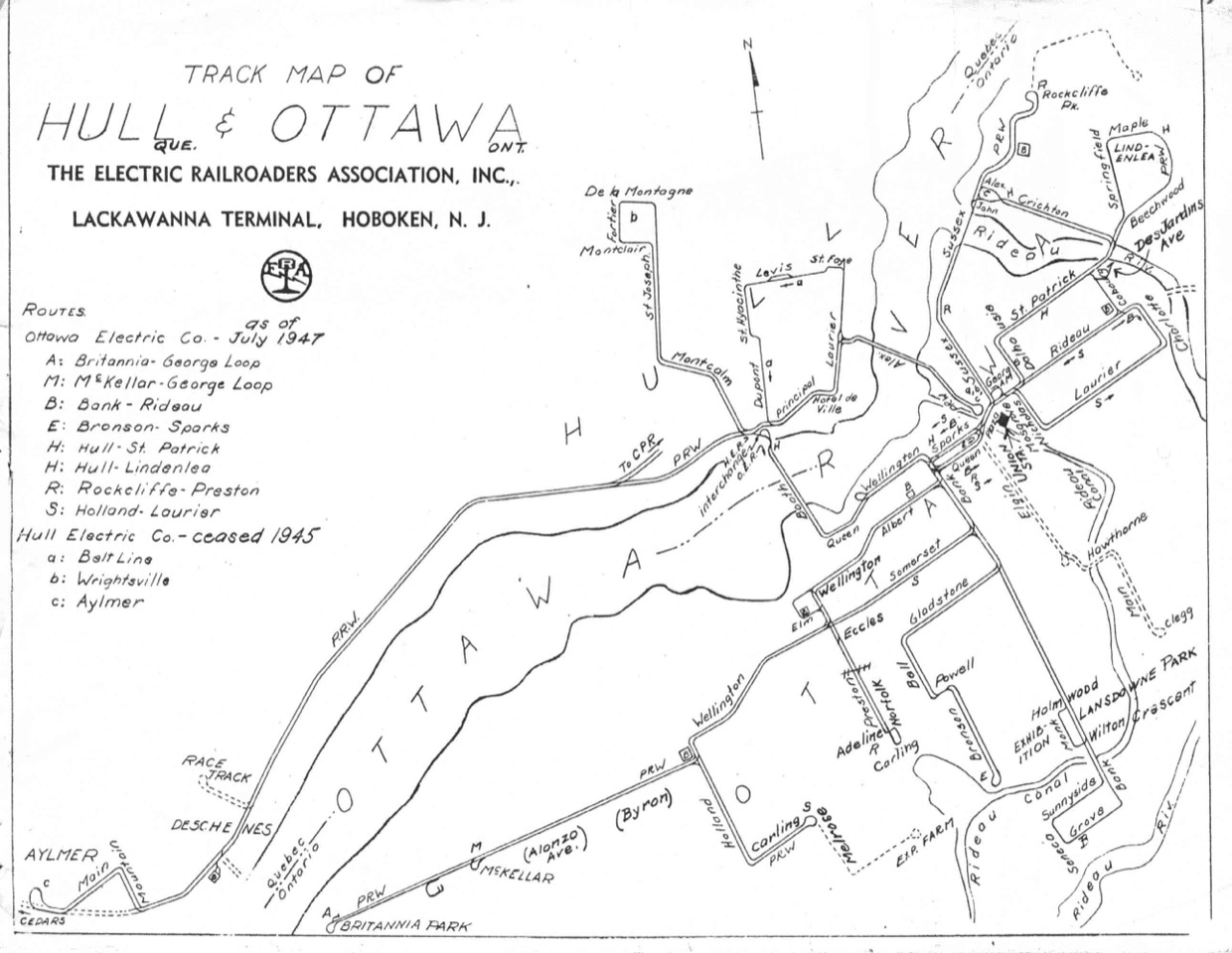
Electric Railroaders Association Map of Hull and Ottawa July 1947
Hull&OttawaElectricMap.jpeg
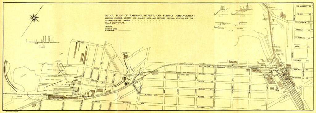
1916 Holt Commission Map of Ottawa Tunnel Proposal
HoltTunnelPlan.jpeg
Updated 2 May 2026
Return to Home Page