Stations in Quebec
A B C D E F G H I J K L M N O P Q R S T U V W X Y Z| Location | Details | Notes |
| Blue Sea Village, QC Rue Principale east side behind houses. GPS 46.182602, -76.057243 | Flag stations from CP Orio and CP Ellard | Need picture |
| Breckenridge, QC 130 du Village | CP (PPJ) first Breckenridge station | Need to verify |
| Breckenridge, QC 1911 Chemin de la Montagne | CP second Breckenridge station | Need to verify |
| Burnet, QC | May still exist. | |
| Calumet, QC 169 rue Principale GPS 45.648991, -74.640866 | CP (QMO) Calumet station disused | 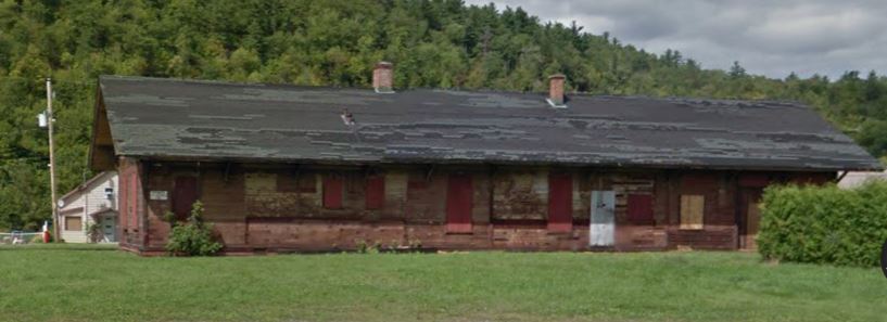 Street View September 2011 |
| Cascades, QC | Moved to Cross Farm, near Chelsea in the mid-1960s. The property is slated for development and the well preserved station was temporarily moved in April 2021. It is expected to be moved later in 2021 to the former railway being converted to a recreational trail.. | 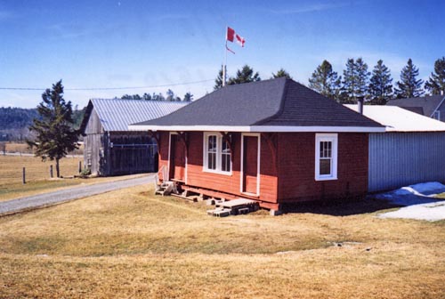 |
| Clemow, QC - See Gracefield | ||
| Farm Point, QC Intersection of route 105 and Farm Point road, north east cormer behind white house | CP Farm Point station used as storage | Need picture |
| Farm Point, QC 17 Cross Loop Rd off Rte 5, behind farm house among buildings. GPS 45.597877, -75.901635 | CP Cascades station used as storage | Need picture |
| Farrelton, QC Plunkett Rd. behid a house across from side of church GPS 45.740876, -75.908636 | CP Lordsvale station moved from original site to a point west of hwy 105. The actual Farrelton station - a section foreman's house - is gone | 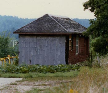 Lordsvale station Photo by Bruce Ballantyne |
| Fassett, QC 111-113 rue St-Charles on highway 148 | CP Fassett station moved east of original site and north of tracks, private residence | In 1998 Railway station guide. |
| Gatineau, Hull, QC 199 Rue Montcalme at railway crossing on south side of crossing. GPS 45.430710, -75.729316 | HCW Hull station, in situ, built for the opening of the HCW in July 1992, then became a restaurant (the Laurier sur Montcalme) when HCW operations were cut back to the Hull shop area two years later, disused. | 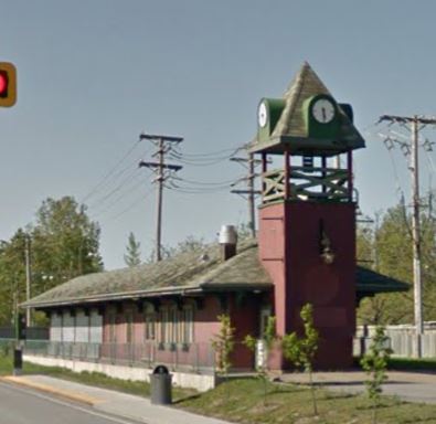 Street View May 2015 |
| Gracefield, QC From Gracefield on to Blue Sea Lake road then 3.6 km to rue de Lac Paquin then 4 km to Gracefield Camp. Station at back of clearing | CP Clemow station, camp building used for arts and crafts. | 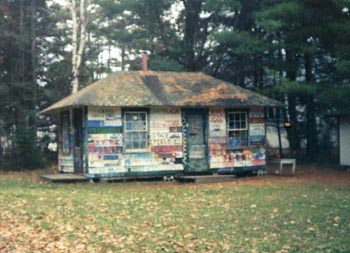 Photo by Bruce Ballantyne |
| Gracefield, QC 351 Chemin Mark, south of Gracefield and west of hwy 105 GPS 46.051417, -76.098639 | CP
Perras station, moved from original location and next to a farmhouse.
F.W. Perras was mayor of Gracefield (1913-1918 and 1923-1926). Photo by Bruce Ballantyne October 2015 | 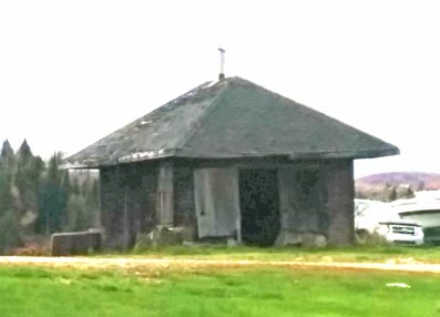 |
| Lachute, QC South on Bethane off rue Principale (route 158) to Berry Street, west on Berry GPS 45.656237,-74.333823 | CP Lachute station in situ. | 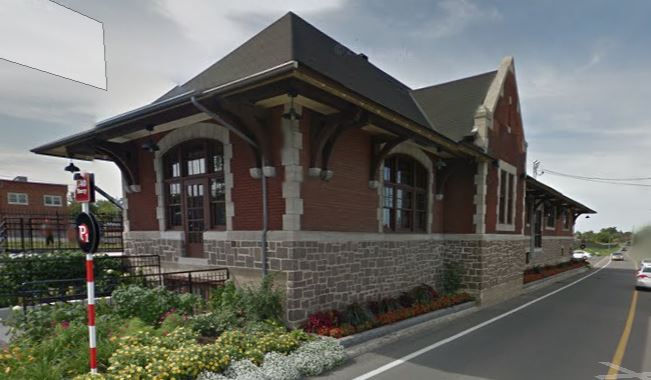 Street View Aug 2011 |
| Lachute, QC 46 Rue Water CN (CNoR/GN) Lachute station GPS 45.658537, -74.335444 | 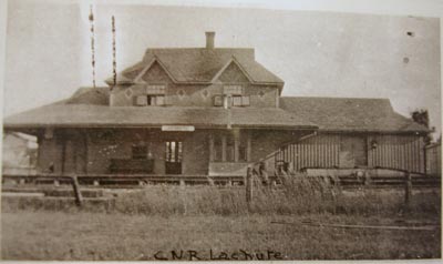 Claude Martel, Quebec Railways Historical Research Institute. Thanks to Gerry Gaugl. | 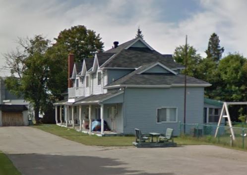 Street View |
| Lusk, QC In Luskville between highway 148 and a house on 'du Village'. Moved from mp 18.1 Waltham subdivision, in a farmers wooded fiels east of Luskville off highway 146. Used as a granary. | 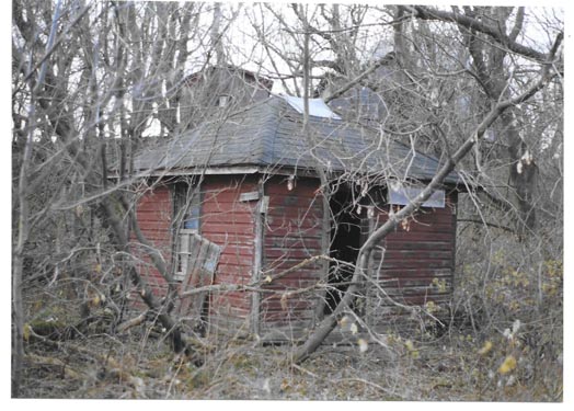 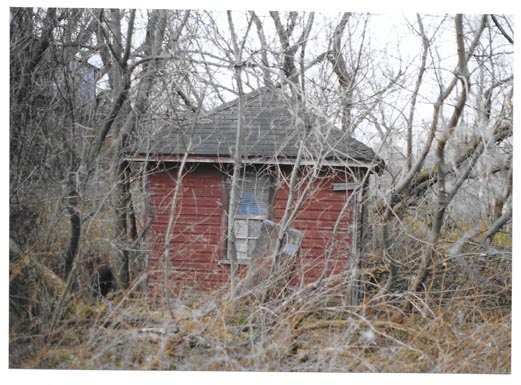 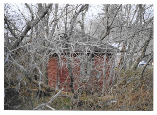 Pictures taken by Bruce Chapman on November 9, 2003 | |
| Marelan, QC Route 148 and Scotch Road (west of Lachute) | CP Marelan station, unused, in situ | In 1998 Railway station guide |
| Masson, QC GPS 45.547178, -75.417498 | QG (CP/QMO&O) station, disused? Buckingham Junction or Masson was opened on 27 December 1877 on the Montreal to Hull line of the Quebec, Montreal, Ottawa and Occidental Railway. It became part of the Canadian Pacific Railway and saw the first Montreal to Vancouver passenger train pass on 28 June 1886. | 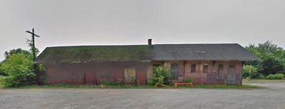 Street View July 2014 |
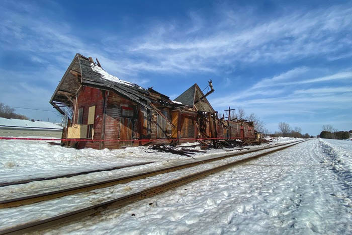 The roof of Masson station collapsed on 11 March 2021, photo by Mike Tessier same date. | ||
| Mohr, QC Mohr flag station moved from original location GPS 45.5530444, -76.1020278 | 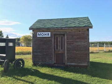 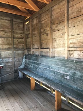 | 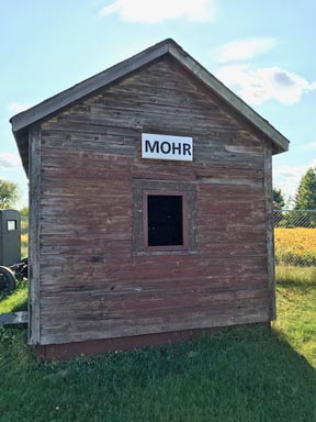 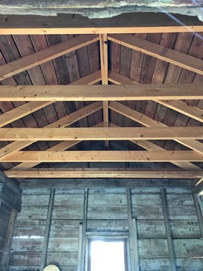 |
| Montebello, QC GPS 45.6499487,-74.9431309 | 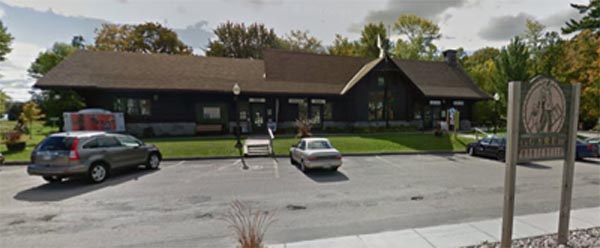 Google Streetview September 2012 CP Montebello 1931 log cabin style station now used as the Montebello Tourist Office/ Bureau d'information touristique de Montebello. Next to Chocomotive | |
| Montebello, QC | Original CP 1877 Montebello station, used for storage and garage | In 1998 Railway station guide but may not now exist. |
| Parker, QC On river front, near original site off highway 148, 4 km west of Luskville | CP (PPJ) Parker station, private residence. | 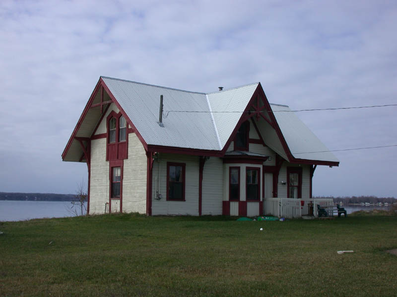 |
| Patterson, QC | CP Patterson station near Larrimac, moved from original site | In 1987 Guide. May be gone |
| Pendleton, ON Moved to 26 Rue St. Pierre, Rigaud | CPR station from Montreal and Ottawa subdivision. | |
| Quyon, QC 8110 O'Reilly Road GPS 45.6117735,-76.2915075 CP Quyon station, moved from original site on Monday 20 October 1980 and used as a dwelling. | 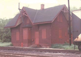 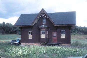 Left Quyon station at original location Right Quyon station after being moved, 1982. (Pat Brennan collection) From the Ottawa Citizen 20 October 1980 Man buys railway station A moving experience For a dollar, Ottawa consultant Stephen Bancroft bought a chunk of history that no one else wanted. All he had to do was move it. The century-old, two-storey, CPR Quyon train station, about 45 kilometres northwest, of Ottawa, hadn't been used for about four years and was destined for demolition until Bancroft noticed it a few months ago. Bancroft and CPR officials had no trouble making a deal. Canadian Pacific wanted to clear the land and the 46-year-old Bancroft wanted a place for a bar and social facilities for his planned country retreat in Onslow. But there was a catch he had to move the 12-by-16 metre building by trailer and it was going to cost more than $7,500. And today was to be moving day. Bancroft, a police escort and hydro crews were to make the 15-km; trek along Wolf Lake Road to his 750 acres of land in Onslow at 9 a.m. By 10, Bancroft hoped Pontiac County residents would go easy on their electricity. At peak times the 110,000-watt main power line that crosses the road drops by more than 30 centimetres 30 centimetres: too many for his load to fit underneath. Saturday, when he first put the station on the trailer a half-metre thick steel beam snapped in half. "Every cent I own has gone into my dream," he said Sunday. Renovations to the old station will cost him more than $20,000. "I always wanted a train station, I almost bought one a few years ago but my wife didn't want me to." | |
| Shawville, QC Shawville Exhibition Grounds GPS 45.603649, -76.487226 | CP (PPJ) Shawville station | 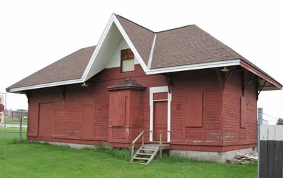 Malcolm Vant photo 2009 |
| Venosta, QC Chemin Gare, 100m west off route 105 GPS 45.868822, -76.023789 CP Venosta station in situ. | 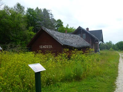 Photo by Stu Moxley August 2015
| 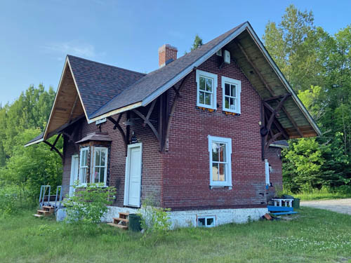 Photo by Jean-Louis Ozorak 2023 |
| Wakefield, QC Rue Principale, Wakefield GPS 45.639241, -75.928992 | CP Wakefield station, in situ, restaurant. Pot au Feu | 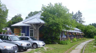 Photo by Stu Moxley August 2015 |
Updated 6 July 2023
