Stations in Ontario
A B C D E F G H I J K L M N O P Q R S T U V W X Y Z| Location | Details | Notes |
| Alexandria, ON North side og McDougald Street East GPS 45.317956, -74.639839 | CN (GT) station, built 1917. Still in use by VIA | |
| Alfred, ON | CP Alfred station, Relocated to property at Part Lot 28, Concession 1, used as private residence | No details |
| Ashton, ON Behind house at 2071 Ashton Station Road at Junction with Blacks Corners Road, east side. GPS 44.643872, -75.966786 | CP Ashton station | Need picture |
| Athens, ON Plum Hollow Road (County Road 5) at intersection with Lake Eloida Road and Hard Island Road . GPS 44.6464584,-75.9763449 | CN Athens station moved from original site and used as residence. | 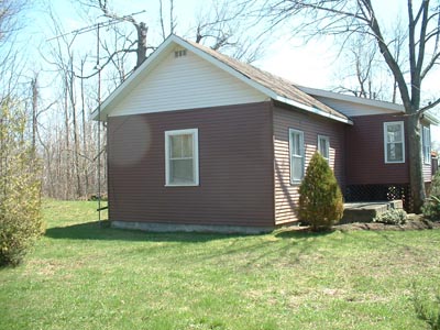 Bob Moore photo. |
| Athens, ON On Temperance Lake south of Athens. | CP Prescott station, used as summer cottage. | Need picture |
| Aultsville, ON see Upper Canada Village |
| |
| Bannockburn CNR (BQR) station Outside Ottawa study area |
The
Madoc station is actually called Bannockburn Station |
 |
| Barrys Bay, ON Opeongo Street, Highway 60 GPS 45.487955, -77.676347 | CN (OA&PS) station in situ used as a cultural centre / art gallery / very small museum of local railway history / visitors' information centre |  Photo by Jeff Hill 25 July 2015 |
| Barryvale, ON Highway 511 south of Calabogie, 45.290437,-76.691874. | Peter Archibald writes The Barryvale station on the K&P line was just a mile or two south of Calabogie, and was not much more than a large shed with a hip style roof at both ends. When the line was abandoned and rails taken up in the early sixties, the station was moved to the north side of the Lanark road where it was used as a year round cabin by an old "Mr.Barry", whom I assume was a descendant of the same Barry family of Barryvale (a daughter of the pioneer Barry family having married the O’Brien tycoon of Renfrew, a coincidence of him having met her while surveying for the railroad through the same area later named by the railroad as "Barryvale"). Old Mr. Barry died (tragically) only a few years later (late 60s, early 70s) at which time the old station structure sat idle and then later was put into use as a shed, and today, still existing as an outbuilding along the north side of the Lanark road. It sits at the end of the drive for the first residence encountered after having turned left from the Barryvale road towards Calabogie. If you know what you are looking for, you can spot it plainly from the road. | |
 Barryvale station - Google Streetview |
||
| Bathurst, ON, see Wemyss | ||
| Bellamy, ON NE of highway 29, 8720 County Road 28. 1.5 km north of crossing on west side. Approx. 1.2 km east of original site. GPS 44.6940386,-75.8235937 | Former
CP Bellamy station used as a dwelling. . |  Photo by Andrew Jeanes, 19 June 2012. |
| Blakeney, ON North of Almonte right off hwy 15 on Blakeney Road on a farm near Blakeney | CP former Snedden station, standard portable. | In 1998 Railway station guide. |
| Bourget, ON 139 Rue Levis GPS 45.440011, -75.168813 CP Bourget station in situ, now a private home | 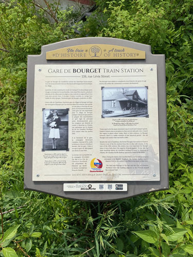 Photo by Raymond Farand 11 June 1923 | 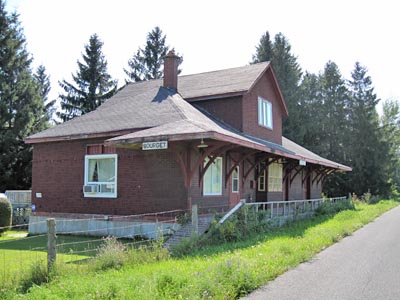 Photo Malcolm Vant August 2009 |
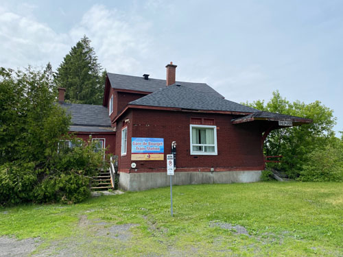 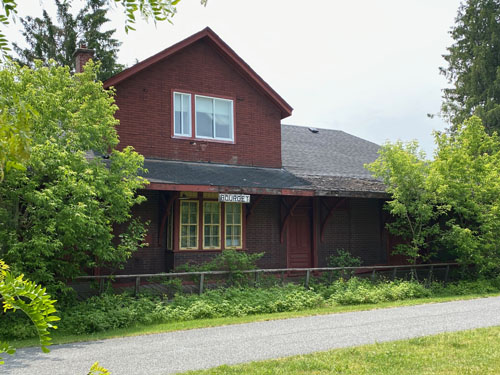  Photos by Raymond Farand 11 June 2023 |
||
| Brockville, ON 68 William Street GPS 44.593909, -75.689681 | Brockville VIA (CN/GT) station in use by VIA and restored in 2015. | 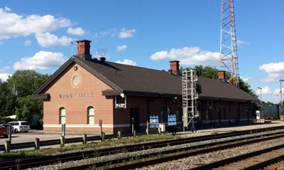 Photo by Andrew Jeanes, 9 August 2015 |
| Caintown, ON Near Mallorytown | CP Fairfield flag station moved originally to Athens then Caintown | Need to verify |
| Carleton Place, ON Coleman Street at Beckwith (Highway 15) GPS 45.135913, -76.134735 | Former CP Carleton Place Station, built 1921-22. No longer used as a daycare but more recently occupied by the Carleton Place Chamber of Commerce. The chamber of commerce moved out as of early 2015, and the building is now home to the Ginger Café and Hamsa Yoga Studio. | 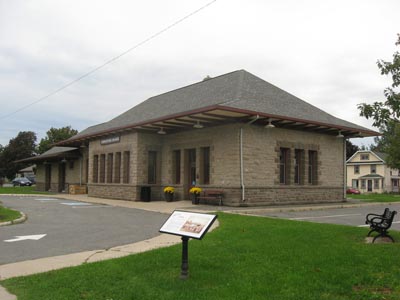 Photo by Andrew Jeanes September 2013 |
| Casselman, ON Still in railway use Photo by Gerry Gaugl 24 May 2020 | 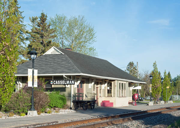 | |
| Castleford, ON 2.4 km west of crossing | CP Castleford station, | In 1987 Guide. Need to verify. |
| Chesterville, ON On property in Nation River valley at 13170 Nation Valley Rd. GPS 45.083155,-75.243267 | Rebuilt as a garage, appearance altered | 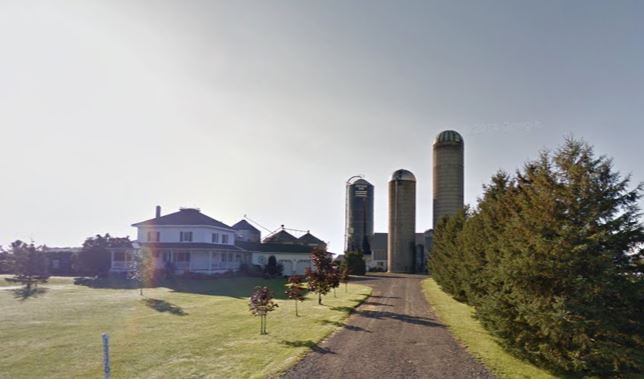 Street View September 2013 |
| Clarendon, ON 8 km north off hwy 7 on hwy 509, east on Clarendon Road about 150 meters, on right side behind white house. GPS 44.873454, -76.696764 CP station in situ. | 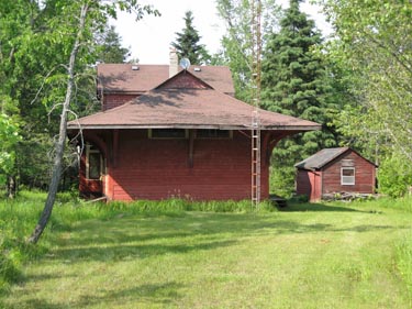 2013 Photo by Malcolm Vant | 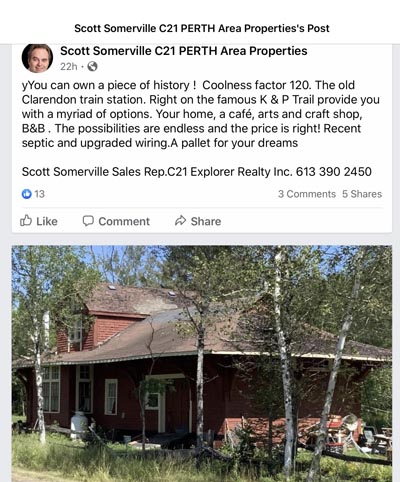 |
| Cornwall, ON North end of station road GPS 45.042103, -74.743542 | Opened by CN in 1958, currently operated by VIA with CN maintenance workers using the east portion. | Need picture |
| Cumberland, ON Cumberland Heritage Village Museum GPS 45.517719, -75.391217 | Former CN Vars Station, built by the GTR 1908-1909. Relocated to the Cumberland Heritage Village Museum in 1976. | 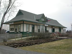 Photo by Andrew Jeanes, 12 April 2006. |
| Cumberland, ON GPS 45.5179638,-75.4145434 | Former CN (CNoR) Cumberland Station, built by the Canadian Northern Ontario Railway in 1909. Relocated a short distance west of its original location to 2460 Hillmar Street.and in use as a residence. | 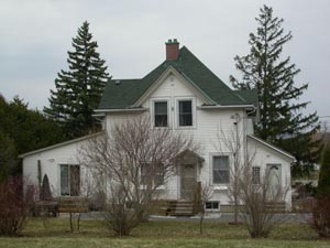 Photo by Andrew Jeanes, 12 April 2006. |
| Dunrobin, ON 1210 Thomas A. Dolan Parkway GPS 45.417937,-76.027388 | CN
Dunrobin station on the Kennedy farm moved a short distance from
original
location. The owner told us there used to be Dunrobin signs on all
sides of the building but the CN asked them to remove them as it was
confusing to the engineers. He thinks they are still around
somewhere and may put them up again if he can find them. He and his
brother have maintained the building. It has a new metal roof and has
been painted relatively recently | 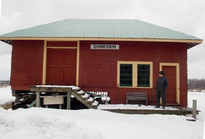 Photo provided by Chris Gardner 3/2018 |
| Deux Rivieres, ON | CP Deux Rivieres station relocated to property within community off Hwy. 17 and used as a summer resort cabin | Need Picture |
| Eastons Corners, ON Junction hwys 15 and 41 | CP stations from Bell and Story are used as farm buildings, | In 1987 Guide. Need to verify. |
| Eastons Corners, ON | CP Yule station on a farm towards North Augusta | In 1987 Guide. Need to verify. |
| Edwards, ON | NYC Edwards station, moved to property on road between Navan and Sarsfield | Need to verify |
| Eganville, ON Highway 512 just west of Highway 41 GPS 45.528297, -77.113568 | CN (GTR) station in situ, private residence | 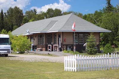 Jeff Hill photo 24 July 2015 |
| Embrun, ON 989 Notre Dame Street GPS 45.273015, -75.278870 | NYC St Albert Station used as private dwelling | 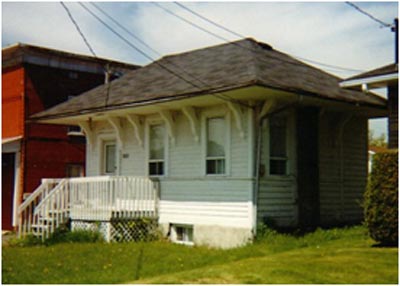 Photo by Les Goodwin |
| Embrun, ON 24 Bourassa Street GPS 45.2738134,-75.2820634 | NYC Russell station, private residence | 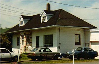 Photo by Les Goodwin |
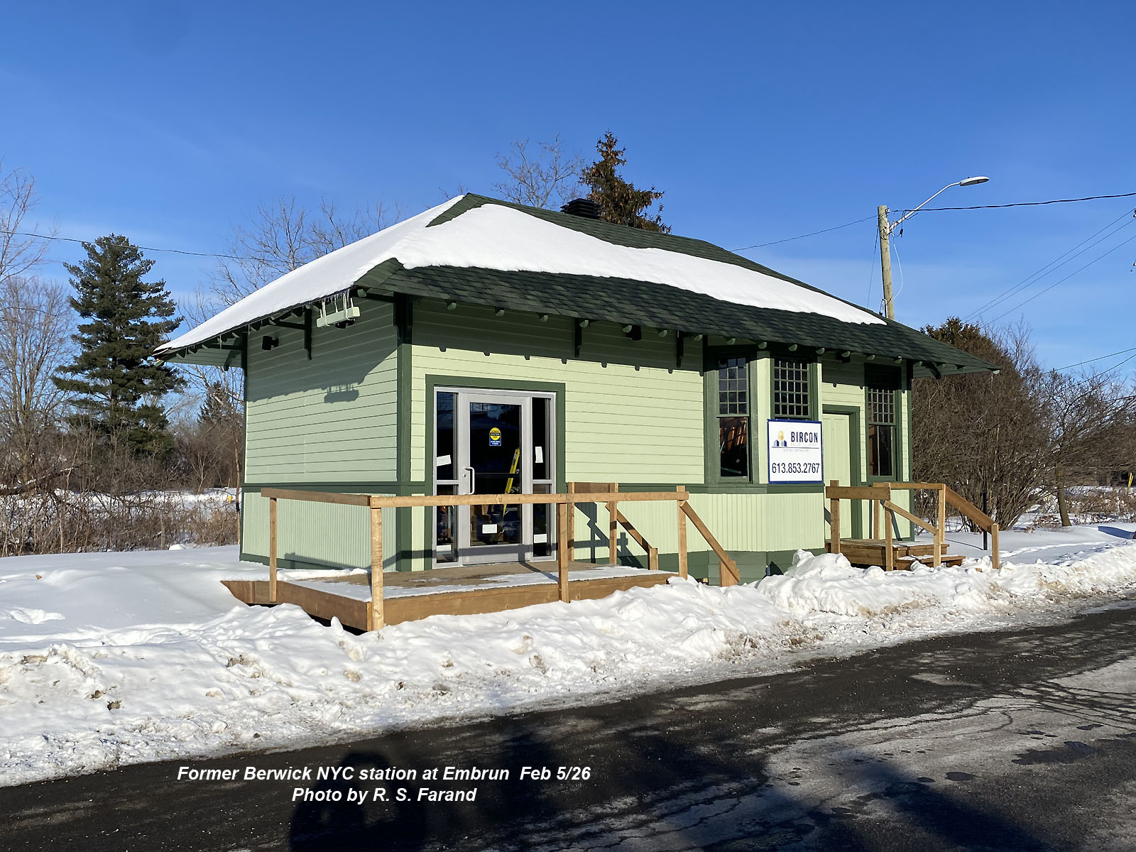
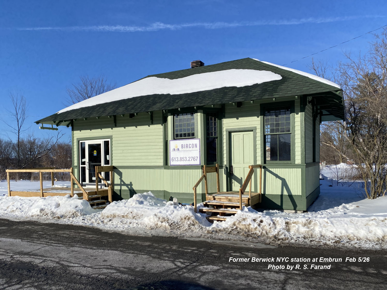
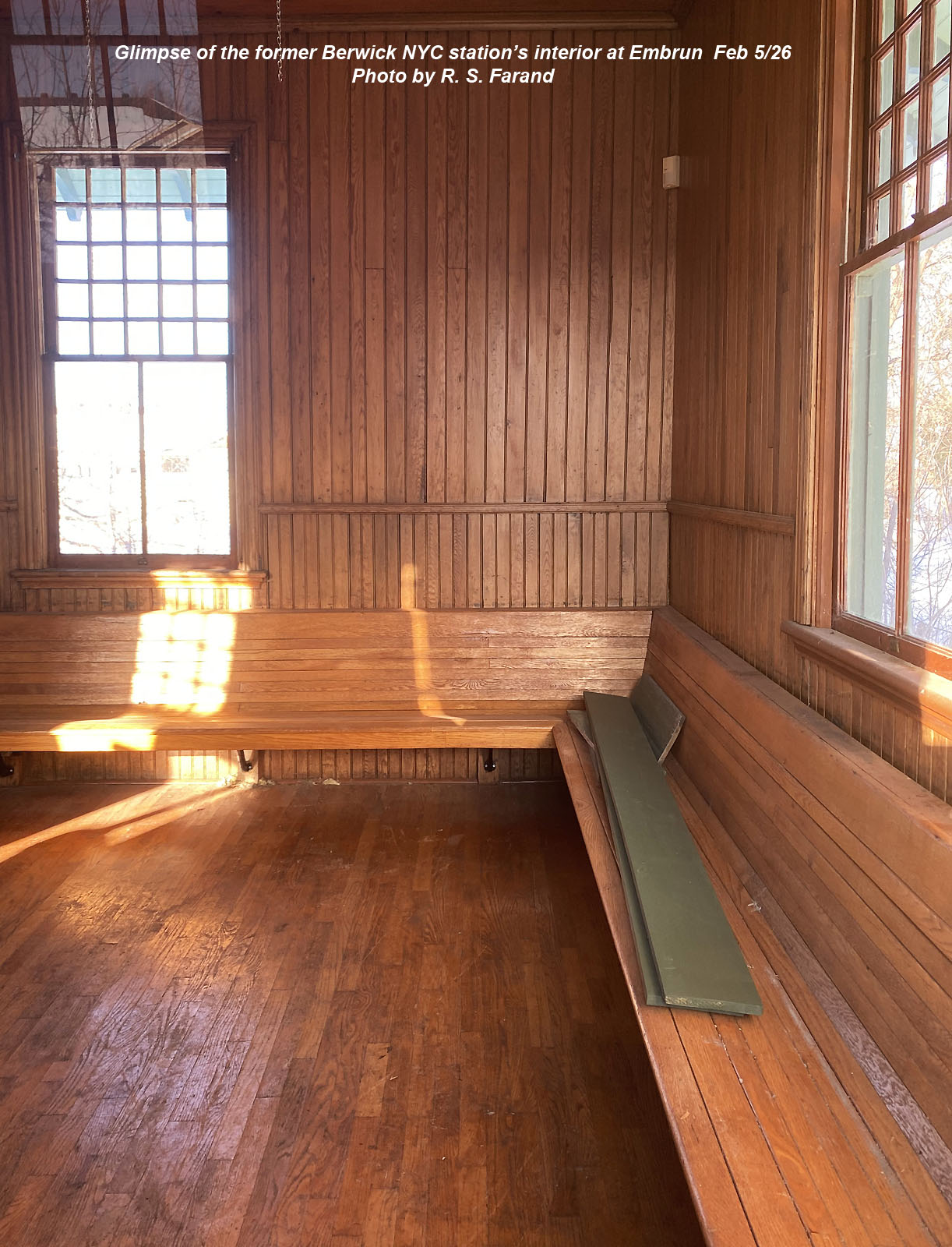
| Embrun, ON Relocated to property at rue Notre Dame and rue Blais in Embrun | NYC Berwick station, used as an information centre | 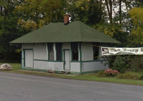 Street View September 2013 |
 |
 |
|
| Pictures
of Berwick station at Embrun taken by Raymond Farand on 5 Fenruary
2026. Used as a tourist information booth the building is now mounted
on a concrete slab. |
||
| Erinsville, ON Highway 41 26.5 km north of highway 401 | Former CN (BQR) station, Erinsville. No longer used by the municipal roads department but now in use as a community centre. | 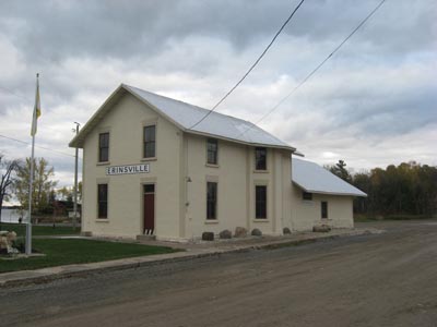 Photo by Andrew Jeanes, 22 October 2011. |
| Ernestown, ON South on highway 133 from highway 401 towards Millhaven GPS 44.217195, -76.754917 | CN Ernestown Station, built by the Grand Trunk Railway in 1856. Its current ownership is unclear but it remains vacant and unused. | 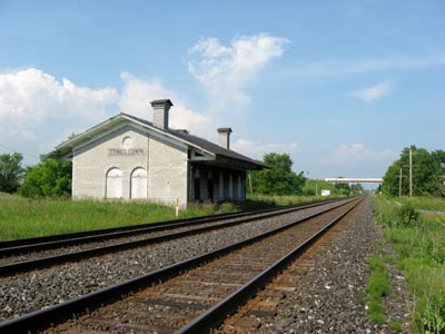 Photo by Andrew Jeanes, 27 June 2008. |
| Fairfield (East), ON County. Rd. #5 at Temperance Lake Rd. GPS 44.580595 -75.905416 Note the official CP timetables showed "Fairfield" yet people in the area called it "Fairfield East". | Former CP Fairfield (East) station, relocated away from right-of-way and in use as a shed. Photo by Andrew Jeanes, 21 May 2013. |  Photo by Andrew Jeanes, 21 May 2013. |
| Forthton, ON Former Brockville and Westport (later CNoR/CN) Forthton station. Built circa 1886, relocated a short distance from the former right-of-way and very deteriorated. North west of Brockville at junction of hwys 29 and 42 on north west cormer behind barn buildings. It is sitting beside the original roadbed, but turned perpendicular to it. GPS 44.640544, -75.860272 | 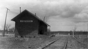 Bob Moore photo (CSTM Mattingly) in original location 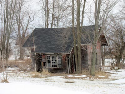 Photo Malcolm Vant 25 March 2017 | 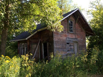 Photo by Andrew Jeanes, 9 August 2015 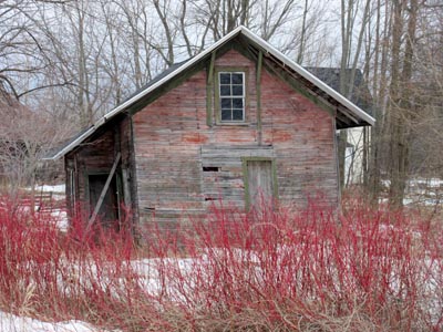 Photo Malcolm Vant 25 March 2017 |
| Franktown, ON West of highway 15 on Perth Road (County Road 10) east of CP crossing on north side. | Former CP Franktown Station, moved a short distance away from the former right-of-way and in use as a residence. |  Photo by Andrew Jeanes July 2012 |
| Gananoque, ON GPS 44.3685,-76.153432 | CN/VIA Gananoque Station, built by the GTR in 1901. Still in railway use. | 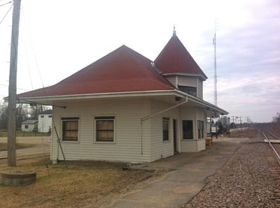 Photo by Andrew Jeanes, 21 April 2014 |
| Gananoque, ON At former crossing with highway 3 in Gananoque | CN (TIR) Flag stop, in situ | 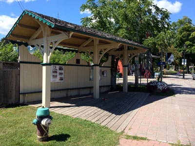 Photo by Andrew Jeanes, 9 August 2015 |
| Glenbrooke, ON 19299 Heron Road GPS 45.1525218,-74.6244377 | Former CP Glenbrook station, relocated away from the former CP Cornwall
Sub. right-of-way and used as a residence. | 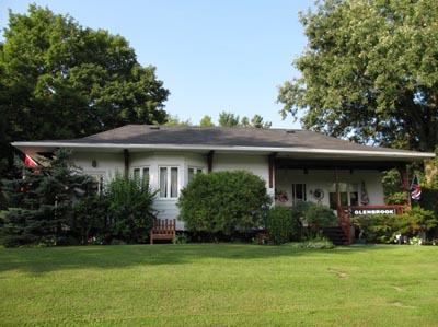 Photo by Andrew Jeanes, 22 July, 2010. |
| Glen Elbe, ON | CN (BWSSM) Glen Elbe station was moved from original site and may still be in existence. | More information and picture needed. |
| Glen Tay, ON | CP Glen Tay station name board in Petro Canada gas station | In 1987 Guide. Need to verify. |
| Glen Tay, ON see Wemyss | ||
| Goshen, ON Near original site between Renfrew and Glasgow | CN Goshen station on a farm | Need picture |
| Hungerford, ON Off Sulphide Road at Hungerford, west of Kaladar. | CP station, in situ, private residence | Outside Ottawa study area |
| Inkerman, ON | See Mountain | |
| Kingston, ON 810 Montreal Street GPS 44.253834, -76.484709 | CN Kingston "Outer Station", originally built by the Grand Trunk
Railway in 1855 and used for passenger service beginning October 27,
1856. |  Andrew Jeanes photo 2014 |
| Kingston, ON 167 Ontario Street GPS 44.228207, -76.481536 | The former CN "Inner" Station, also known as Hanley
Station (for the original station agent). It was opened by the Grand
Trunk Railway in 1885 and closed as a passenger station in 1930. Andrew Jeanes took this photo on June 10, 2007. The
building has served many purposes over the years but has been home to
Frankie Pesto's Italian Eatery since at least the early 2000s. | 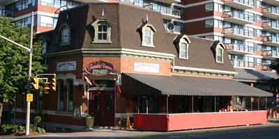 Andrew Jeanes photo 2007 |
| Kingston, ON 209 Ontario Street, across from City Hall GPS 44.229235, -76.480259 | The former CP Kingston Station, originally built by the
Kingston and Pembroke Railway in 1884. It saw its last passenger train
on June 16, 1957. Andrew Jeanes took this photo on November 24, 2011. This
station has been well cared-for and serves as a tourist information
centre and gift shop in Confederation Park, across from Kingston City
Hall. | 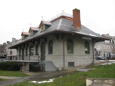 Andrew Jeanes photo 2011 |
| Long Sault, ON GPS 45.032899, -74.853495 | Former CN (ex-GTR) Moulinette station, relocated to Lost Villages Museum in Long Sault. | 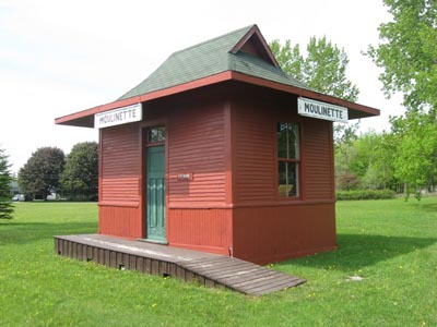 Photo by Andrew Jeanes, 25 May 2014. |
| Lyn, ON | CN station used as a dwelling, moved from original site, rumored to be down by the St. Lawrence.. | In 1998 Railway station guide |
| Madoc, ON see Bannockburn | CN (BQR) station in situ. Outside Ottawa study area | See Bannockburn |
| Manotick, ON 6020 Mitch Owens Road GPS 45.253235,-75.630877 | CP Manotick station, used as a dwelling and moved from original site. |  Photo Les Goodwin |
| Marlbank, ON County road 32, south end of town Outside Ottawa study area | CN (BQR) station, in situ, used as dwelling | 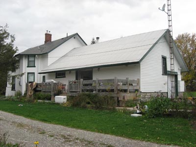 Photo by Andrew Jeanes, 22 October 2011. |
| Marmora, ON West end of town on north side of highway 7 Outside Ottawa study area | Former Central Ontario Railway (later CNoR/CN) Marmora station. Relocated to a park in Marmora. |  Photo by Andrew Jeanes, 6 July 2007. |
| Merrickville, ON Near junction of County Roads 15 & 41 behind red brick house among bushes | CP Bells Crossing and Story flag stations used for storage. | In 1998 Railway station guide |
| Mississippi, ON | CP (K&P) station in situ, dismantled, moved to private property. | |
| Morrisburg, ON East off highway 31 just south of Highway 401 interchange GPS 44.914184, -75.192676 | CN Morrisburg station, built in 1957 and still in active railway use as a MOW base. Photo by Andrew Jeanes, 25 May 2014. |  Photo by Andrew Jeanes, 25 May 2014. |
| Moulinette, ON see Long Sault | ||
| Mountain, ON In Mountain, County road 1, east of Kemptville | CP Mountain station, private residence | In 1998 Railway station guide |
| Mountain, ON Near Mountain, at 2191 County Road 1 GPS 45.0334748,-75.4682792 | CP Inkerman station, now a private residence. | Need picture |
| Napanee, ON GPS 44.253475, -76.954487 Outside Ottawa study area | CN/VIA Napanee Station, built by the Grand Trunk Railway in 1856. Now owned by the town, with half the station occupied by a woodworking studio. Also in railway use. |  Photo by Andrew Jeanes, 18 September, 2010. |
| Napanee, ON Outside Ottawa study area | Former CN (BQR) station, Napanee, relocated a short distance from the tracks and in use as a pub. | 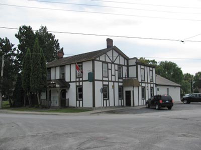 Photo by Andrew Jeanes, 18 September 2010. |
| Navan, ON Township road betwen Sarsfield and Navan. | NYC Edwards station, private residence | In 1998 Railway station guide |
| Newburgh, ON Outside Ottawa study area | Former Bay of Quinte Railway station, Newburgh. In use as a residence. | 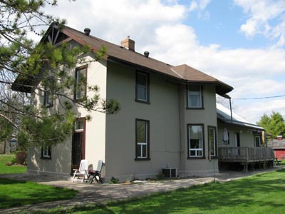 Photo by Andrew Jeanes, 20 April 2010. |
| Northfield, ON GPS 45.047383, -75.089878 | Former NYC Northfield station relocated to property on west side of road leading out from
town, used as storage shed. From Chris Granger 4/2020 As we passed through Northfield Station ... I noticed that the station building is not long for this world. The middle of the shed has collapsed in on itself and the walls on the east and west sides are falling inwards. | 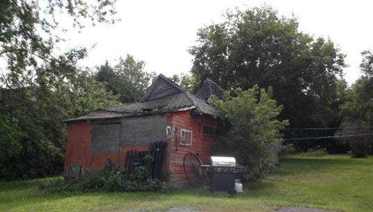 Lost Villages Historical Society 2020 |
| Ottawa, ON Britannia Park Trolley Station GPS 45.363418, -75.800678 OER iron frame shelter, in situ, Britannia Park | 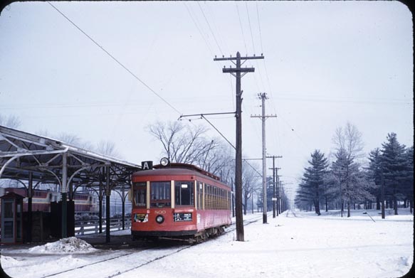 Car 800 at Britannia on 12/14/1958 Bob Sandusky photo via Bruce Chapman | 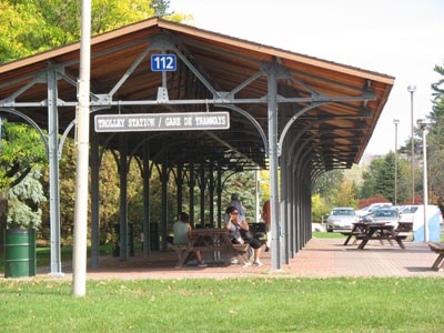 "Old streetcar station, Britannia, Ottawa" by Dmitri Lytov |
| Ottawa, ON Confederation Square. GPS 45.424807, -75.694157 | CN (GTR) Union station, Being converted for use by the Senate, formerly government conference center. | 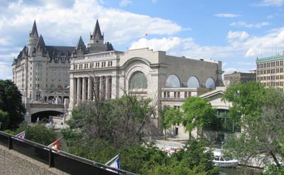 Photo by David Jeanes 2012 |
| Ottawa, ON OER Concrete Shelters Acacia Avenue 01 - GPS 45.456512,-75.6801665 Three on south side of George Etienne (Rockcliffe) Parkway 02 - GPS 45.454128,-75.687359 03 - GPS 45.455542,-75.6855 04 - GPS 45.456719,-75.683094 On south side of cycle/pedestrian path 05 - GPS 45.446927, -75.688499 | 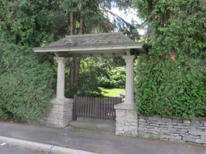 01 - Acacia Avenue Colin Churcher 7 August 2015 | 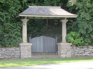 02 - Rockcliffe Parkway Colin Churcher 7 August 2015 |
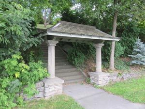 03 - Rockcliffe Parkway Colin Churcher 7 August 2015 | 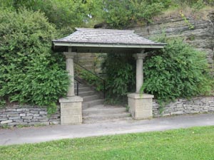 04 - Rockcliffe Parkway Colin Churcher 7 August 2015 | 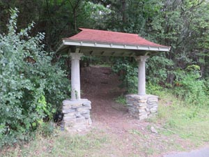 05 - Rockcliffe Cycle/Pedestrian Path Colin Churcher 7 August 2015 |
| Ottawa, ON OER shelter at Rockcliffe Parkway Overlook GPS 45.453795,-75.688245 | 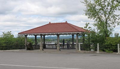 Colin Churcher 7 August 2015 | |
| Ottawa, Gloucester, ON | Part of CN Blackburn station moved to Maxime Street. | In 1987 Guide. Need to verify. |
| Ottawa, Kanata, ON On Constance Lake, north east of highway17 2380 Dunrobin Road GPS 45.405748,-76.000501 | CN Malwood flag station, part of summer house | Need picture |
| Pakenham, ON West off highway15 in Pakenham on to White Fish Lake Road, ½ km west to Five Arches Drive at end of street on left hand side. | Former CP Pakenham Station, moved a short distance away from the former right-of-way and in use as a residence. | 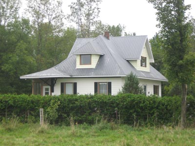 Photo by Andrew Jeanes, 15 September 2013. |
| Pendleton, ON Moved to 26 Rue St. Pierre, Rigaud | CPR station from Montreal and Ottawa subdivision. | |
| Prescott, ON GPS 44.710798, -75.524798 | CN/VIA Prescott Station, built by the Grand Trunk Railway in 1855. Now occupied by the Grenville County Historical Society. | 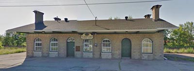 Colin Churcher Street View 2013 |
| Queenborough, ON Concession road 13, southwest corner of village (north of Tweed on County Road 20. Outside Ottawa study area | CN (Bay of Quinte Railway) Queenborough station in situ, (spelled Queensboro by railway) | 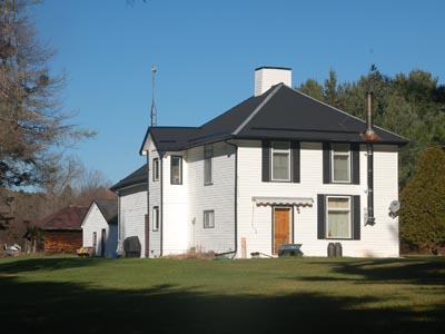 Rob Hupfield photo 8 Nov 2015 |
| Rockland, ON Central Counties/Canada Atlantic/Grand Trunk/Canadian National station much modified 844 St. Jean Street GPS 45.545025, -75.291853 | 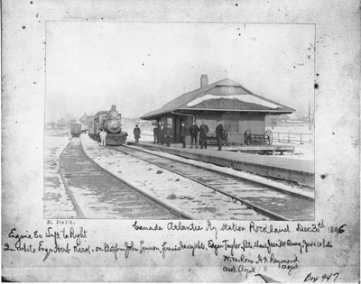 CAR station Rockland 30 December 1896 with locomotive 80. LAC C54520 | 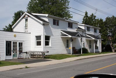 Photo by Fred Adams July 2017 |
| Smiths Falls, ON 53, Victoria Avenue, Smiths Falls GPS 44.905513, -76.017275 | Former CP station in situ. Station Theatre | 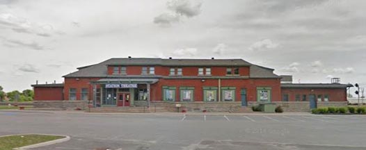 Colin Churcher Street View June 2012 |
| Smiths Falls, ON 90 William Street GPS 44.901636, -76.028393 | CN (CNoR) Smiths Falls station in situ, Railway Museum of Eastern Ontario | 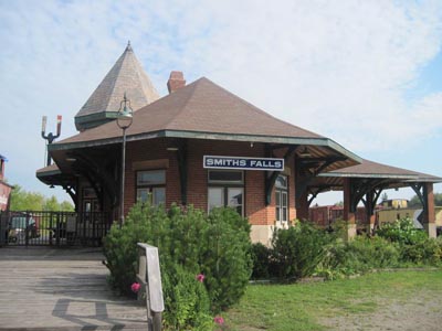 Photo by Railway Museum of Eastern Ontario |
| Smiths Falls, ON 90 William Street GPS 44.901636, -76.028393 Railway Museum of Eastern Ontario | CN Nolans flag station | 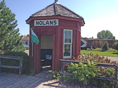 Photo by Bill Seabrooke |
| Snow Road, ON | CP (K&P) Snow Road station, dismantled, moved to property on Millar Lake. Building partially resembles original | |
| Stardale, ON | CP Stardale station Relocated to property in Caledonia Twp (Part Lot 14, Concession 6) | No details |
| Stoco, ON On county road13 3 km south of Tweed on north side and west of Stoco Outside Ottawa study area | CN (BQR) station, in situ and used as a dwelling. | 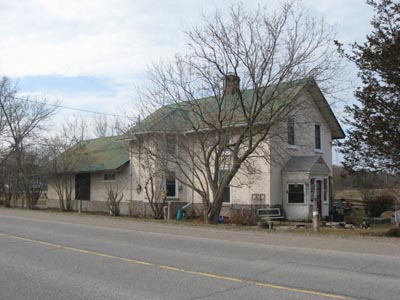 Photo by Andrew Jeanes, 18 March 2012. |
| Tamworth, ON Southwest corner of village. Outside Ottawa study area | Former CN (BQR) station, Tamworth, in situ. In use as a residence. | 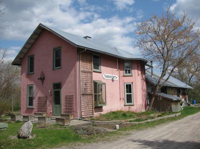 Photo by Andrew Jeanes, 20 April 2010. |
| Upper Canada Village, Crysler Park GPS 44.940387, -75.094757 | Former CN (ex-GTR) Aultsville station, relocated to Crysler Park, Upper Canada Village. | 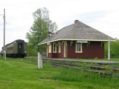 Photo by Andrew Jeanes, 25 May 2014. |
| Wemyss, ON Across Highway 7 from the OMYA calcium carbonate plant in Glen Tay, about 6 km west of Perth. | Former CP Bathurst station now a residence. This was moved about seven kilometres *east* to Glen Tay. Bathurst remained a station name on CP employee timetables at least into the 1960s, however the local post office changed its name to Wemyss much earlier than that, supposedly to avoid confusion with Bathurst, NB. There was never a CP station named Wemyss. The two station buildings 3.7 miles apart (railway distance) managed to each be relocated to the other's approximate former location. |  Photo by Andrew Jeanes, 28 May 2012. |
| Wemyss, ON Just south of Highway 7 and the former Havelock Sub right-of-way, west of the Bathurst 5th Concession Road. | Former CP Glen Tay station, relocated to Wemyss and used as a residence. There is confusion about the surviving stations around Glen Tay. There are two: Glen Tay itself, which has been moved about seven kilometres *west* to Wemyss and Bathurst (see above) There never was a CP station that had the name Wemyss. |  Photo by Andrew Jeanes, 20 May 2012 |
| Wilbur, ON | CP (K&P) station moved to unknown location | |
| Winchester, ON | CP Winchester station, used as a dwelling and moved from original site. | In 1987 Guide. Need to verify. |
| Yonges Mills, ON | CN (GTR) design flag station moved to a farm | In 1987 Guide. Need to verify. |
Updated 3 March 2026
